geophysics data Downloads
-
ZondRes2Dp - Resistivity + IP 2D Data Interpretation Software in Polygonal Way (land, borehole) Brochure
for integrated geophysical data interpretation. ...
-
ZondMAG3D - 3D Gravity and Magnetic Interpretation Software Brochure
and geophysical methods, helps to provide integrated interpretation of geological and geophysical data. ...
-
BHEditor - Software for Lithological Columns Creation Brochure
types of apriori information during the geophysical interpretation of the data is very ...
-
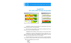
ZondMT1D - MT (AMT, RMT) 1D Data Interpretation Brochure
with the results borehole and other geophysical methods data and results. ...
-
ZondSP2D - 2D Electric Self Potential Data Interpretation Software Brochure
in the software. The possibility to import and view the other geophysical methods data, and first of all ...
-
QCTool - Version V4.0.1 - Software for Windows Brochure
GeoTutor V is EMIGMA-based software featuring a whole range of modeling, data display and inversion capabilities for Gravity, Magnetic, TEM (borehole, airborne, ground), FEM (airborne, ground and crosshole), MT/CSAMT, and IP/Resistivity (ground, borehole and crosshole). It can be used by practicing geologists dealing with a limited number of data or for self-instruction and survey design as well ...
-
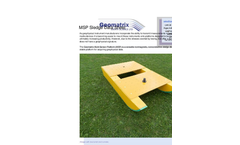
Geomatrix - Model MSP Sledge - Multi Sensor Platforms - Datasheet
As geophysical instrument manufacturers incorporate the ability to transmit measurements in real time to external media devices it is becoming easier to mount these instruments onto platforms designed to be towed by a vehicle, ultimately increasing productivity. However, due to the stresses exerted by towing, few offer a durable platform which does not have a geophysical signature. The Geomatrix ...
-
EarthSoft and C Tech Announce New EQuIS interfaces to EVS and EnterVol
and discover the trends in your geophysical data in any environment (e.g. soil, groundwater, surface water, ...
-
Agenda PDF - AERMOD Modeling Computer Laboratory
This 2-day course is designed for environmental professionals with little dispersion modeling experience who wish to use the AERMOD model or to better understand AERMOD results provided by others. Course topics include source characterization, building and terrain data, and results interpretation. The course includes hands-on modeling exercises and interactive lectures. It can be taken with the ...
-
Air Dispersion Modeling Brochure
access to raw meteorological and geophysical data and is proficient in analyzing and ...
-
Geomatrix Multi Sensor Platform (MSP) Sledge Datasheet
As geophysical instrument manufacturers incorporate the ability to transmit measurements in real time to external media devices it is becoming easier to mount these instruments onto platforms designed to be towed by a vehicle, ultimately increasing productivity. However, due to the stresses exerted by towing, few offer a durable platform which does not have a geophysical ...
-
Air Dispersion Modeling
-orological and geophysical data and is proficient inanalyzing and processing these data for input ...
-
ZondMT2D - MT (AMT, RMT) 2D Data Interpretation Software Brochure
geophysical and geological information. Other known data formats (Mackie, Rebocc) are also supported. The ...
-
RMT - Data Processing and Interpretation Software Datasheet
Electrotomography data interpretation ADVANCED GEOPHYSICAL OPERATIONS AND SERVICES INC. 162 Oakdale Rd., ...
-
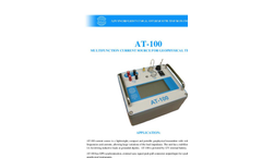
AGCOS - AT-100 - Multifunction Current Source for Geophysical EM Surveys Datasheet
AT-100 MULTIFUNCTION CURRENT SOURCE FOR GEOPHYSICAL TECHNIQUES APPLICATION: AT-100 ...
-
AGCOS - MARY-24 - Multifunction Low-Frequency Geophysical EM Receiver Datasheet
be transferred to PC for further in-lab data processing. ADVANCED GEOPHYSICAL OPERATIONS AND SERVICES ...
-
Dams Overview Brochure
dimensions. This kind of data enables dam owners to efficiently install monitoring wells and ...
-
Exploration And Resource Development Brochure
monitoring • Exploration target ranking, assessment reports • Data compilation, acquisition, ...
By SGS Geostat
-
Environmental Overview Brochure
with data from a Willowstick geophysical investigation. This approach allows for an ...
-
Mining Overview Brochure
placed observation wells with data from a Willowstick geophysical investigation. This approach ...
Need help finding the right suppliers? Try XPRT Sourcing. Let the XPRTs do the work for you
