spectroradiometer News
-
International Distributors Wanted
LR TECH, A CANADIAN BASED COMPANY, IS LOOKING FOR INTERNATIONAL DISTRIBUTORS IF YOUR ORGANISATION ALREADY DISTRIBUTES ANALYTICAL INSTRUMENTS TO AEROSPACE, DEFENSE, ENVIRONMENTAL, FIRST RESPONDER, AND METEOROLOGICAL MARKETS, WE CAN WORK TOGETHER. CONTACT US AT: network@lrtech.ca FIND MORE AT: www.lrtech.ca Our Company Founded in 2003, LR Tech manufacture FTIR-based solutions for ...
By LR Tech
-
Greenland`s glaciers losing ice faster this year than last year, which was record-setting itself
Researchers watching the loss of ice flowing out from the giant island of Greenland say that the amount of ice lost this summer is nearly three times what was lost one year ago. The loss of floating ice in 2008 pouring from Greenland's glaciers would cover an area twice the size of Manhattan Island in the U.S., they said. Jason Box, an associate professor of geography at Ohio State, said that ...
-
Researchers Provide Detailed Picture of Ice Loss Following the Collapse of Antarctic Ice Shelves
An international team of researchers has combined data from multiple sources to provide the clearest account yet of how much glacial ice surges into the sea following the collapse of Antarctic ice shelves. The work by researchers at the University of Maryland, Baltimore County (UMBC), the Laboratoire d'Etudes en Geophysique et Oceanographie Spatiales, Centre National de la Recherche ...
-
LED & LIGHTING quality evaluation the new DELTAOHM SpectroRadiometer HD30.1
LEDs cannot be manufactured with consistent optical properties as a result of the production processes involved. Brightness and color can vary substantially from component to component even in the same production batch. This is why LEDs have to be tested during production and in their final application. Comprehensive optical characterization is also essential during research and development of ...
-
ASTM E1336 - 11 standard test method for obtaining colorimetric data from a visual display unit by spectroradiometry
The most fundamental method for obtaining CIE tristimulus values or other color coordinates for describing the colors of visual display units (VDUs) is by the use of spectroradiometric data. (See CIE No. 18 and 63.) These data are used by summation together with ...
-
Greenland`s rising air temperatures drive ice loss at surface and beyond
Greenland's enormous ice sheet is home to enough ice to raise sea level by about 23 feet if the entire ice sheet were to melt into surrounding waters. Though the loss of the whole ice sheet is unlikely, loss from Greenland's ice mass has already contributed in part to 20th century sea level rise of about two millimeters per year, and future melt has the potential to impact people and economies ...
-
Satellite cluster proves link between pollution and weather systems
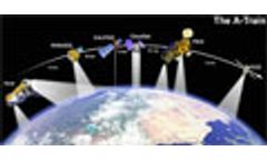
Using data from instruments in a constellation of NASA and French satellites, scientists are learning more about the link between clouds, pollution and rainfall. Four NASA satellites - Aqua, Aura, CloudSat and CALIPSO and the French Space Agency's PARASOL - make up the string of satellites in the Afternoon Constellation, more commonly called the A-Train. They orbit only eight minutes apart and ...
-
New generation of Chinese environmental monitoring satellite now in orbit
China has successfully launched the first of its new generation of polar-orbiting meteorological satellites, Fengyun-3A. Fengyun-3A was launched on 27 May 2008 from Taiyuan satellite launch centre in Shanxi Province of China. The payload of this new generation spacecraft is comprised of a complex suite of instruments including visible and infrared imagers, infrared and microwave sounders, a ...
-
Groundbreaking study finds the `hotspots` most responsible for deforestation
A new collaborative study by WRI and other researchers finds that much of the world’s deforestation is isolated in a handful of “hotspots,” not spread out over many nations and many locations. In fact, this study showed that over half the world’s deforestation (in this study only clear-cut are monitored) is happening in just two locations: 48% is occurring in Brazil, with another 13% concentrated ...
-
NASA Sets Sail on Second Leg of Arctic Ocean Research Voyage
Scientists embark this week from Alaska on the second and final campaign of a NASA field campaign to study how changing conditions in the Arctic affect the ocean's chemistry and ecosystems. On June 25, the ICESCAPE mission, or "Impacts of Climate on Ecosystems and Chemistry of the Arctic Pacific Environment," resumes its shipborne investigation of the impacts of climate change in the Chukchi ...
-
Tohoku Tsunami Created Icebergs in Antarctica
A NASA scientist and her colleagues were able to observe for the first time the power of an earthquake and tsunami to break off large icebergs a hemisphere away. Kelly Brunt, a cryosphere specialist at Goddard Space Flight Center, Greenbelt, Md., and colleagues were able to link the calving of icebergs from the Sulzberger Ice Shelf in Antarctica following the Tohoku Tsunami, which originated ...
-
New NASA Map Reveals Patterns of Tropical Forest Carbon Storage
A NASA-led research team has used a variety of NASA satellite data to create the most precise map ever produced depicting the amount and location of carbon stored in Earth's tropical forests. The data are expected to provide a baseline for ongoing carbon monitoring and research and serve as a useful resource for managing the greenhouse gas carbon dioxide.The new map, created from ground- and ...
-
NASA Releases Visual Tour of Earth`s Fires
NASA has released a series of new satellite data visualizations that show tens of millions of fires detected worldwide from space since 2002. The visualizations show fire observations made by the MODerate Resolution Imaging Spectroradiometer, or MODIS, instruments onboard NASA's Terra and Aqua satellites. NASA maintains a comprehensive research program using satellites, aircraft and ground ...
-
Climate Models Project Increase in U.S. Wildfire Risk
Scientists using NASA satellite data and climate models have projected drier conditions likely will cause increased fire activity across the United States in coming decades. Other findings about U.S. wildfires, including their amount of carbon emissions and how the length and strength of fire seasons are expected to change under future climate conditions, were also presented Tuesday at the ...
-
Sensors in Space Allow Daily Coastal Water Quality Monitoring
ST. PETERSBURG, Florida, August 31, 2007 (ENS) - Using data from instruments aboard two NASA satellites, Florida researchers have created a way to map the fleeting changes in coastal water quality from space - something that has long evaded researchers and coastal managers relying only on ground-based measurements. This information has direct application for resource managers working on ...
Need help finding the right suppliers? Try XPRT Sourcing. Let the XPRTs do the work for you


