
Sand & Gravel - Case Study
Creating a Borehole Database
A series of exploration boreholes were drilled. Samples were taken every five feet and sieved in order to determine the relative percentages of sand, gravel and clay (or other non-sand/gravel material). These samples were restricted to the interval below the base of the soil profile and the top of the bedrock. The borehole locations, stratigraphy (see Table 1), and sieve analyses (see Table 2) were then entered into a relational database.
Displaying the Boreholes
Two and three-dimensional striplogs were constructed for each borehole.
The two-dimensional logs (Figure 1) include textual descriptions of the lithotypes as well as bargraphs depicting the relative percentages of sand, gravel, and clay. These logs are best suited for printed reports in which all of the borehole information is depicted within a single, albeit complex diagram.
The composite three dimensional logs (Figure 2) show the lithology as color-coded cylinders with bargraphs depicting the sand and gravel content. Although interesting, these logs quickly become confusing when plotting multiple logs in a three-dimensional diagram (Figure 4).
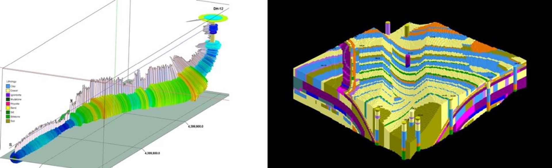
The three-dimensional percentage logs (Figure 3) show the relative concentration of a single constituent
(e.g. % sand). These 'spindle logs' are ideally suited when plotting a single constituent (Figures 5, 8 & 11)
Figure 4: 3-Dimensional depiction of all boreholes
Generating the Initial Sand, Gravel & Clay Models
Solid “block” models for the sand, gravel, and clay data were created by using a modeling algorithm that estimates grade levels for a three dimensional matrix of imaginary blocks.
Computing Sand & Gravel Reserves
The sand and gravel models were combined by adding each of the block values (Figure 14). This combined model was then filtered to show only those regions where the sand and/or gravel are greater than 80 percent (Figure 15). Finally, a pit was generated (Figures 16, 17, & 18) by using a 'floating cone' algorithm that removes material above the ore based on user-defined criteria (e.g. maximum slope, bench height, ore grade, etc.)
Appendix I
-
Most popular related searches
Customer comments
No comments were found for Sand & Gravel - Case Study. Be the first to comment!