
12D Solutions Pty Ltd. software
12d Model - Survey Modelling
The 12d Model Base Product was written from the ground up for the civil and surveying market. Work flow follows traditional engineering ideas, making it very easy to learn and use. The Base includes the many string types to allow accurate civil engineering and survey modelling. Super alignment strings provide independent horizontal and vertical geometry and are created and edited interactively on plan and section views.
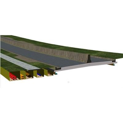
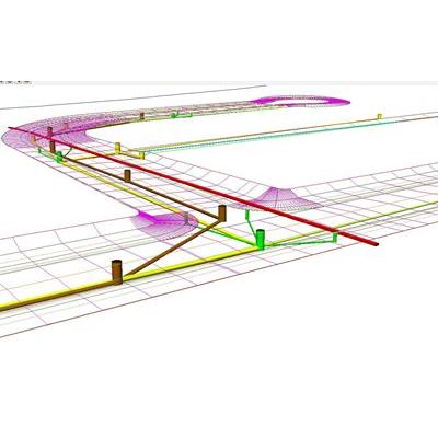
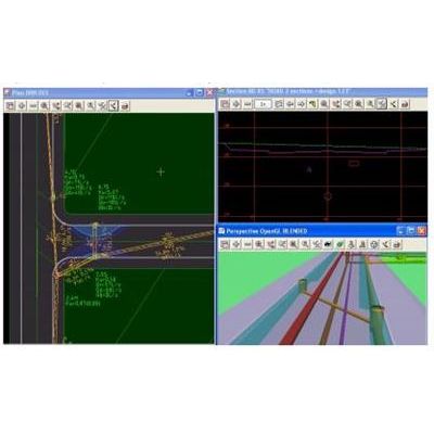
12d Model - Detailed Alignment Design Software
Alignment design adds another dimension to 12d Model, providing the tools to carry out the full range of civil design work, from land development to multi-lane highways with major intersections and exits. The parametric geometry generator (Components) quickly produces fully linked objects for intersections, turning lanes and roundabouts and other complex civil engineering objects.
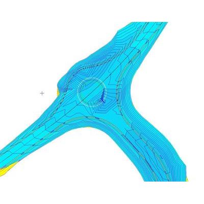
12d Model - Volumetric
There are two parts to the volumetric module, volume calculations and tin analysis. Calculations of earthworks volumes within a user defined polygon using either end area or exact calculations. Volumes can be calculated between a triangulated model and a fixed height or between two triangulated models. Included in the volumes is an auto multiple stock piling routine. With simple field coding the multiple stock pile tins are created and reported.
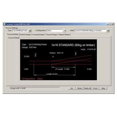
12d Model - Track Software
The Track module is an extension to the Alignment and Volumetrics & TIN Analysis modules. This module has the extra functions to complete track and rail design. In this new version the Super Alignments have new Rail spiral types, Chainage equalities, Compound elements, Duplicate elements (double tracking).
12d Model - Survey Module
With the Survey module, users are able to graphically reduce and edit survey data, apply adjustments and transformations, create and label subdivisional (estate) lots and create upload setout data. The graphical Cadastral traverse spreadsheets are included.
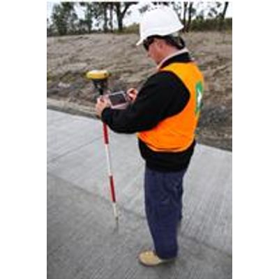
12d Model - Field Software (Setout, Pick-up, Tunnel)
12d Field provides a new and innovative way for Surveyors and Engineers to collaborate, access and use design and survey data outside the office. By allowing these professionals to access the full functionality of 12d Model from the field using fully Windows capable tablet devices, the office can be taken out into the field. Having this functionality on hand means that operations that once had to wait to be processed back in the office, such as conformance calculations, are available on demand, improving efficiencies in all areas of construction projects. 12d Field has been developed to enable surveyors to connect and communicate with 12d Field capable Total Stations and GPS instruments.
12d Model - Urban Drainage Software
The Drainage module allows the design and management of horizontal and vertical drainage networks, typically those required for new land subdivisions and development projects. Existing drainage networks can be reproduced easily for analysis or realignment designs. The drainage string itself consists of pits or manholes, joined by straight or curved pipes. Invert levels and pipe grades can be automatically adjusted, set and modified either graphically or by typed input. Manhole and pipe type libraries are able to be customised to suit local authorities or manufacturers.
12d Model - Drainage Analysis Software
The drainage analysis module allows for hydrological and hydraulic analysis of a drainage network. Site specific rainfall data can be entered and stored in a rainfall file that can be utilised across many projects. Using the Rational method, catchments with variable runoff characteristics can be created and maintained, with time of concentrations calculated by typed input or automatically determined by graphical flow path creation. Multiple catchments can be assigned to pits or manholes in the drainage network
12d Model - Dynamic Drainage Software
The dynamic drainage module allows detailed hydrological and hydraulic modelling based on volumetric (hydrograph) methods and hydraulics based on the St Venant equation. Complex hydraulic situations including adverse grades, flow reversal, tidal outfall, flap gates and fixed backwater can be modelled within the network due to the introduction of Dynamic Wave calculations. Many types of conduit configurations can be included in the drainage network such as rectangular and trapezoidal conduits, as well as weir and orifice configurations.
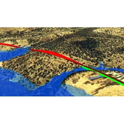
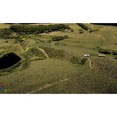
12d Model - Rivers and Flooding Software
12d Model Rivers modules offer river engineers and mappers new levels of flexibility, power, and productivity. 12d Model substantially reduces modelling setup time for river, flood plain, and open channel studies. Start with survey data, airborne laser scanning (LIDAR), cross-section data, USGS DEM data, CAD data, or a combination of these to create a ground surface for your river. Include buildings, roads, and channel improvements and design. 12d Model efficiently handles several million points, making it ideal for the dense data that results from LIDAR, photogrammetry and traditional surveys.