
Aeromao Inc products
Fixed Wing Drones
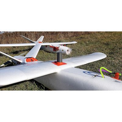
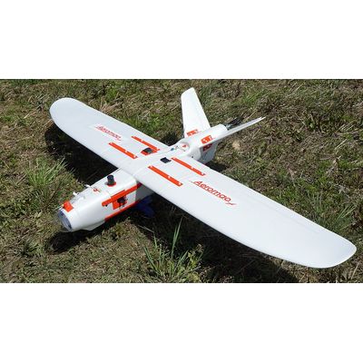
Aeromapper Talon - Fixed-Wing Mapping Drone
The Aeromapper Talon is our best-selling fixed-wing mapping drone. This sUAS turnkey system is ideal for ultra-accurate data collection, scouting, monitoring, mapping, and surveying thanks to its swappable payloads. Among the payloads available in the Emlid Reach M2 multi-band PPK UAV Mapping kit, a 36 Mp RGB (PPK compatible), Micasense Rededge MX, Micasense Altum, and Eyeshot Pro video downlink system for surveillance. But it does not stop there as our Aeromapper Talon is highly customizable with other sensors.
Aeromapper Talon LITE - Commercial Fixed Wing Drone
The Aeromapper Talon LITE offers the lowest cost per surveyed acre, guaranteed. The Aeromapper Talon LITE is an affordable commercial fixed wing drone designed to keep your data collection & operational costs as low as possible, providing the maximum return on investment. With an impressive flight endurance of up to 2 hours and 45 minutes the user can maximize the area mapped in each surveying session. Starting at $6,900 USD, the Aeromapper Talon LITE can autonomously map up to 11Kms2 (2,718 acres) per flight, thanks to its new LiIon battery technology. This is more than twice the area coverage per flight than the leading brand of fixed wing drones, but at a fraction of the cost.

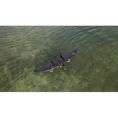
Aeromapper Talon - Model Amphibious - Data Collection and Mapping Drone
The Amphibious version of the Aeromapper Talon allows maritime operations by autonomously belly landing on water. It’s the perfect solution for aerial observation, data collection and mapping thanks to its dual camera set up and video link range up to 20kms. The Aeromapper Talon Amphibious is a Transport Canada Compliant drone.
EMLID
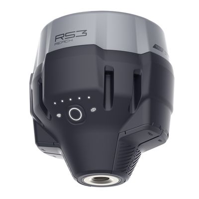
Model Reach RS3 - Multi-Band RTK GNSS Receiver With Tilt Compensation
Accurate Results Even With Large Tilt Angles. The IMU-based tilt compensation in Reach RS3 enables you to make measurements with up to 60 degrees of tilt while still staying within 20mm of accuracy. Reach RS3 continuously measures and corrects tilt in real-time to keep you on the target.
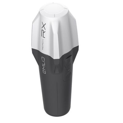
Model Reach RX - Network RTK Rover for Surveying Applications
Reach RX uses the Bluetooth LE connection to your phone/tablet to receive a feed from the Internet, via an NTRIP[?] caster, so you’ll need some NTRIP credentials. But don’t worry if you don’t have NTRIP credentials at the moment, because you could: Use a Reach RS2+ as your base-station, employing Emlid’s easy NTRIP casterfor the task; or pick up some NTRIP credentials from a local, government, or large-network NTRIP provider [extensive list], and operate their own NTRIP caster, e.g. using source code from GitHub.] (For advanced users).
Others
Aeromao VT-Naut - Vertical Takeoff and Short Landing Fixed-Wing Drone
The VT-Naut is a VTOSL (Vertical Takeoff and Short Landing) fixed-wing drone, an innovative aerial solution meticulously designed to cater to diverse applications, including accurate mapping, surveying, inspection, scouting, observation, and agriculture, with a multitude of payloads that will be offered.
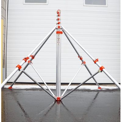
Aeromao - Telescopic Masts
Our sturdy aluminum telescopic masts are perfect tools for elevated photography, survey stations, antenna deployment, sports filming, internet, ideal for either quick or permanent deployments. Available in extensions from 18ft to 60ft but still very portable. The widest base area from similar masts out there, offering the ultimate in stability and safety.