

AgTerra Technologies, Inc. software
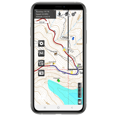
AgTerra Technologies - Model MapItFast - Mobile GPS Mapping App
MapItFast from AgTerra Technologies is a versatile GPS mapping app designed for mobile devices, bringing efficiency to field operations. The app supports mapping points, lines, areas, and photos with a single tap on both Apple and Android devices, functioning even offline in remote areas. It allows real-time collaboration and data sharing among team members, enabling enterprise-level field operation management. Users can create custom electronic forms with Strider Forms & Reporting, integrated with MapItFast, and automate report generation. The professional version offers advanced features like custom basemaps, data dictionary dropdowns, and robust user management via the MapItFast Web console. Data exports in formats like shapefile, KMZ, and GPX are supported for compatibility with third-party GIS software. MapItFast caters to diverse applications such as crop consulting, invasive species control, expense reporting, and lab sampling, revolutionizing data collection and reporting in field operations.
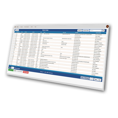
AgTerra Technologies - Strider Forms and Reporting Software
It’s time to streamline your data gathering operations, eliminate paper waste, avoid double-entry and send information exactly where it needs to go. Strider Forms and Reporting does all this and more, automatically. With Strider, you capture field data directly on your Android or Apple device. You get failsafe data protection, even without an internet connection, and automatic syncing to your account while connected. Information you collect is instantly available to be shared among your team members.