

AIRPHOTON / GRASP Earth. software
GRASP Earth - Model Algorithm Open - Generalized Retrieval of Aerosol and Surface Properties (GRASP) Software
GRASP is a highly accurate aerosol retrieval algorithm that processes properties of aerosol- and land-surface-reflectance. It infers nearly 50 aerosol and surface parameters including particle size distribution, the spectral index of refraction, the degree of sphericity and absorption. The algorithm is designed for the enhanced characterization of aerosol properties from spectral, multiangular polarimetric remote sensing observations. GRASP works under different conditions, including bright surfaces such as deserts, where the reflectance overwhelms the signal of aerosols. GRASP is highly versatile and allows input from a wide variety of satellite and surface measurements.
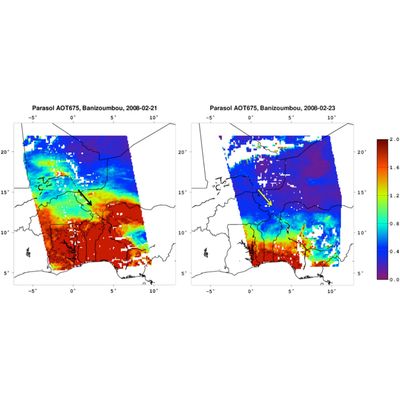
GRASP Earth - Model POLDER-1-2 and POLDER-3/PARASOL - Generalized Retrieval of Aerosol and Surface Properties (GRASP) Software
GRASP algorithm has been applied to the entire archive of the French Space Agency’s POLDER-3/PARASOL (~ 9 years) and POLDER-1 and -2 (~ 1,5 years) instruments, obtaining a wide variety of aerosol and surface characteristics, including Aerosol Optical Depth of extinction (AOD) and absorption (AAOD), Single Scattering Albedo (SSA), Angstrom Exponent (AE), Surface Albedo, NDVI vegetation index, etc.
GRASP Earth - Model MERIS/ENVISAT - Generalized Retrieval of Aerosol and Surface Properties (GRASP) Software
Within the framework of projects supported by ESA, GRASP algorithm has been optimized and applied to the data of MERIS instrument. Two important results have been obtained from those studies:
GRASP Earth - Model ENVISAT-CAWA-2 - Generalized Retrieval of Aerosol and Surface Properties (GRASP) Software
CAWA-2 project intends to use the heritage of the CAWA project as well as the recent advancements realized within the GRASP-Open software package to establish and extend the concept for generating synergy MERIS+AATSR products.
GRASP Earth - Model TROPOMI/Sentinel-5p - Generalized Retrieval of Aerosol and Surface Properties (GRASP) Software
In the framework of ESA S5p+Innovation AOD/BRDF project, the GRASP algorithm is adapted to the development of a product of spectral surface BRDF and aerosol information from (and for) the TROPOMI instrument. S5p/TROPOMI GRASP aerosol and surface products contain direct retrieved aerosol and surface parameters as well as derived aerosol optical properties (spectral AOD, AODF, AODC, SSA etc.) and surface NDVI, spectral DHR (black sky albedo) and spectral BHR_iso (white sky albedo). Both aerosol and surface products are derived at spatial resolution of about 10 km and at UV-VIS-NIR-SWIR 10 wavelengths. Click the button below to get more details and download the data.
GRASP Earth - Model OLCI/Sentinel-3A - Generalized Retrieval of Aerosol and Surface Properties (GRASP) Software
In the framework of EUMETSAT funded projects to support Copernicus Programme, the GRASP algorithm has been adapted and applied to the inversion of Sentinel-3A/OLCI measurements. One year (June 2018 to May 2019) V1.0 aerosol and surface products are derived from the OLCI measurements. OLCI/GRASP retrieval generates both aerosol and surface products simultaneously in the fully consistent manner globally and the products show comparable quality to the community-reference MODIS. Click the button below to download the data.
GRASP Earth - Model GROSAT - Generalized Retrieval of Aerosol and Surface Properties (GRASP) Software
In the framework of ESA “Synergetic retrieval from Ground-based and Satellites measurements: new possibilities for surface characterization and validation” (GROSAT) project, a simultaneous synergistic retrieval of aerosol and surface properties approach (GRASP/GROSAT approach) is developed using combined ground-based AERONET and satellite measurements. In such retrieval the main information about aerosol comes from AERONET direct sun and diffuse sky-radiance measurements, whereas the information about surface reflection properties originates from satellite observations. Such approach allows obtaining the surface reflectance product with enhanced accuracy.
GRASP Earth - Spheroid Package Software
Spheroid package allows fast, fairly accurate, and flexible modelling of single scattering properties by polydisperse randomly oriented spheroids with different size and shape distributions. It includes a software and kernels data base. The details of the scientific concept are described in the paper by Dubovik et al. (2006). The software tool is also, at present, used in GRASP inversion algorithm for retrieving detailed aerosol properties from laboratory or remote sensing polarimetric measurements of light scattering.
GRASP Earth - Model Lidar + Sun/Sky - Radiometer Software
Grasp algorithm provides the possibility state-of-the-art synergetic retrievals inverting simultaneously sun/sky radiometer and lidar ground-based observations. Specifically, the following of these synergetic retrievals can be outlined: