

Bigman Geophysical, LLC services
Utilities
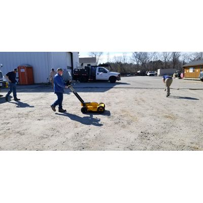
Utility Location & Mapping
Find More Pipes Than Ever Before: Full digital mapping of subsurface utilities presented in BIM, CAD, and GIS formats. We accomplish this by utilizing the full suite of technical equipment including EM locators, magnetic locators, ground penetrating radar, MCGPR, GNSS, and other geophysical technologies. Bigman Geophysical team consists of the most highly trained and specialized operatives in the industry to generate the highest possible level of quality, often at large and complex projects such as industrial facilities, power plants, and airports.
Leak Detection & Pipe Inspection Services
Find Where to Repair: We offer service in pinpointing the location of water or other fluids leaking from pipes and underground storage devices. Our clients appreciate the opportunity to identify exactly where, and often why, a leak has occurred so that they can plan efficient and cost-effective repairs. With access to GPR, pipe cameras, and acoustic equipment, our team has had a high success rate of locating leaks and other problems in pipes and man-made bodies of water.
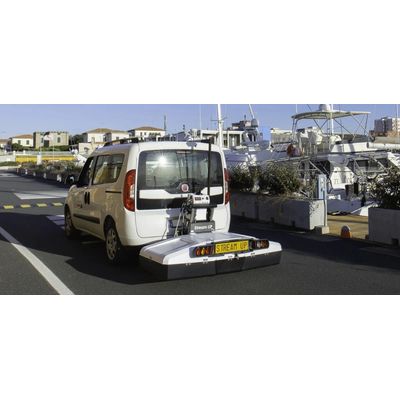
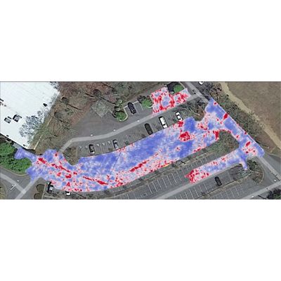
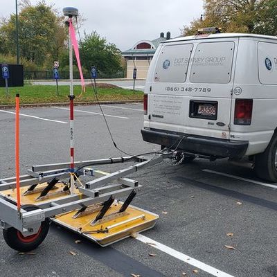
Multi-channel GPR
Exponentially Faster with Better Resolution: These specialized full coverage GPR platforms are designed to create high-resolution top-down imagery with far tighter transect spacing than traditional systems, greatly enhancing survey quality. Multichannel platforms are capable of detecting smaller targets and greater complexity in environments that are often unapproachable to single channel equipment.
Organic Soil Regeneration Bundle
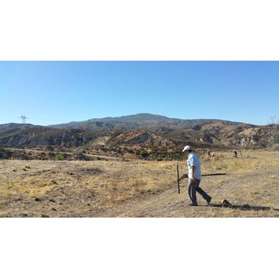
Archaeological Prospection
Non-invasive Imaging of Cultural Herritage Sites. Use the Right Tools: Non-destructive imaging for archaeological targets can be uniquely challenging, especially for sites composed of organic features such as wood and earth. Our team has the technology and experience to detect and model those features in detail, and provide meaningful analysis. Investigations range from individual features to broad area scans targeting whole settlements. Ground-penetrating radar, magnetic gradiometry, electrical resistivity, and magnetic susceptibility are popular modalities for finding and investigating archaeological targets with completely non-invasive technology.
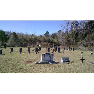
Forensic Investigations & Cemetery Mapping Services
Expert Analysis: We offer non-destructive investigations designed to map unmarked graves and archaeological sites by some of the top experts in the field. Ground-penetrating radar, magnetic gradiometry, electrical resistivity, conductivity, and human remains detection dogs can help identify clandestine graves and generate imagery of even small variations in the subsurface environment. These results can be detailed enough to find even highly decomposed casket-less burials, or those damaged by tree roots or partially destroyed by modern construction. Our team has located burials from recent homicide victims and helped solve cold cases, and has identified graves from thousands of years ago across archeological sites from around the globe.
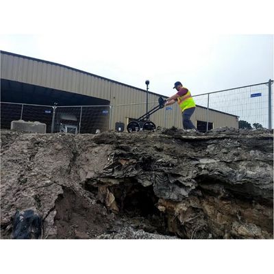
Void & Sinkhole Characterization Services
Full 3D Modeling of Sinkholes: Geophysical analysis can detect and model subsurface features including sinkholes and voids. These investigations can be designed to work in many materials including soil, concrete, stone, and asphalt. Targeted features may be filled with water or air and can have serious and dangerous implications if not detected, mapped, and filled. Our technology and advanced software can model distinctive changes in the subsurface that allow our team to analyze signals and potentially identify void fill material. This can then be presented in many formats including 3D models showing the breadth and possibly volume of the hazard.
Infrastructure
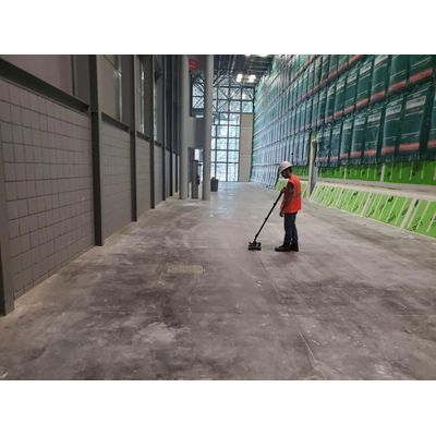
Concrete Scanning
Mapping Utilities, Reinforcements, and Variations in Concrete Structures. Accurate Information is Key to Efficient Management: Concrete scanning can map the locations of embedded utilities and structural reinforcements, and gain insight into the health of structures. Trained technicians can image delamination, honeycombing, void spaces, and general degradation across the walls and floors of structures, to allow informed decision making.
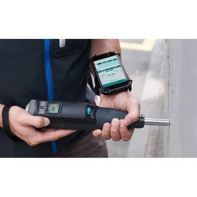
Concrete Testing & Inspection
Know What Condition its Really In
Material Testing of concrete can determine hardness and detect flaws such as honeycombing, delamination, cracks, voids, and other problems.
Non-destructive technology can assess the situation and ensure that decision makers know exactly what they are dealing with.
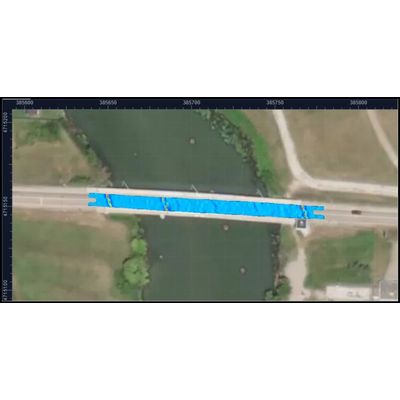
Bridge Deck Inspection Services
Technology for Imaging Material and Reinforcements Inside Bridges. Better Analysis, Better Results: We offer concrete scanning and inspection specialized in the examination of bridges. By examining the material condition, reinforcement health, encased utilities, and geology around the structure we can detect problems and empower our clients for smart decision making.
Road & Pavement Investigation Services
Systems Designed to Scan Paved Surfaces and the Features Beneath Them. The Right Tools for the Job: Pavement assessment systems examine the condition of both paved surfaces and base materials beneath them. These systems are designed to measure material thickness and detect problems with water drainage and washout, utility locations, and damages along miles of roadway.