

Bluesky International Ltd. services
GeoStream Services
GeoStream is a service offering unlimited access to Bluesky’s mapping data. The service includes access to Bluesky’s Great Britain and Ireland high resolution aerial imagery, the unique National Tree Map, DSM, DTM and our MetroVista oblique imagery of urban areas.
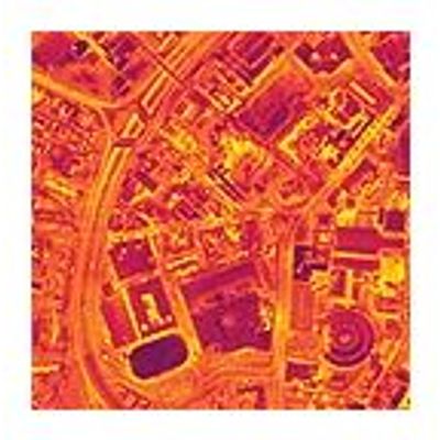
Thermal Mapping Service
The thermal mapping service from Bluesky is an intelligent thermographic spatial information source for deriving property-level building heat-loss maps, used to identify poorly insulated buildings and “Beds-in-Sheds” illegal dwellings. Bluesky provide an end-to-end thermal mapping solution, offering a cost-effective airborne thermal survey service measuring building heat-loss levels across an entire city in just one evening. Thermal Mapping can also be used in forestry studies to identify individual diseased or infested trees.