

- Home
- Companies
- Caliper Corporation
- Software
Caliper Corporation software
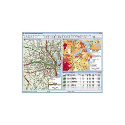
Maptitude Geographic Information System (GIS) Software
Maptitude Geographic Information System (GIS) software gives you the tools, maps, and demographic data you need to analyze and understand how geography affects you and your business. Every day you have to contend with spreadsheets and databases filled with vast amounts of customer, employee, sales, facility, and territory data. With Maptitude mapping software you can visualize data in new and different ways, unearth geographic patterns hidden in your data, and convey that information in a straightforward manner. Maptitude provides everything you need to realize the benefits of desktop mapping and spatial analysis with a single, easy-to-use package.
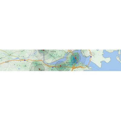
TransCAD - GIS Software for Transportation Planning
TransCAD is the first and only Geographic Information System (GIS) designed specifically for use by transportation professionals to store, display, manage, and analyze transportation data. TransCAD combines GIS and transportation modeling capabilities in a single integrated platform, providing capabilities that are unmatched by any other package. TransCAD can be used for all modes of transportation, at any scale or level of detail.
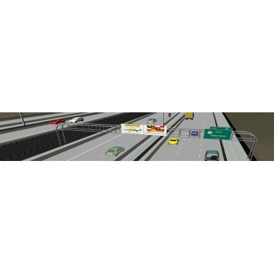
TransModeler - GIS Traffic Simulation Software
TransModeler is a powerful and versatile traffic simulation package applicable to a wide array of traffic planning and modeling tasks. TransModeler can simulate all kinds of road networks, from freeways to downtown areas, and can analyze wide area multimodal networks in great detail and with high fidelity. You can model and visualize the behavior of complex traffic systems in a 2-dimensional or 3-dimensional GIS environment to illustrate and evaluate traffic flow dynamics, traffic signal and ITS operations, and overall network performance.