

- Home
- Companies
- Catena Analytics
- Products
Catena Analytics products
Geographic Information System - GIS - eRAMS Data
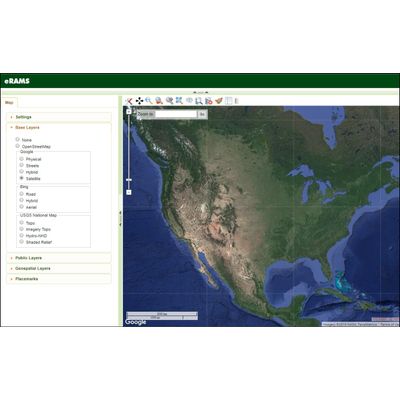
eRAMS Base Layers
Base Layers are user selected representations of the land surface that can be viewed at multiple scales. Base layers form the foundation of a map and can be selected or deselected by clicking on the radio button next to each layer. Base layers cannot be user modified and only one basemap can be selected at any time. Below you will find a description for each type of Base Layer available using the eRAMS GIS/Analysis interface.
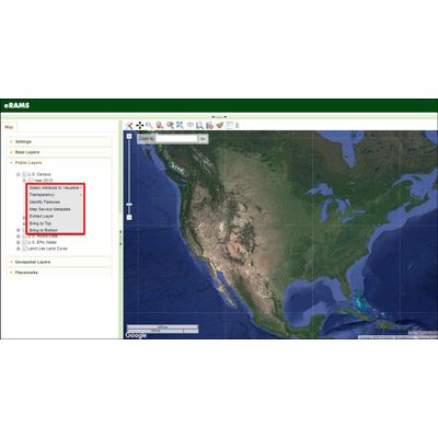
Spatial Layers
Several common GIS layer operations are available using the eRAMS GIS interface. Layers can be added, animated, organized, downloaded and extracted. Metadata can be generated and modified. Folders can be created, organized and shared. Users can also create and manipulate layers made from existing table information with options to join information from features that are spatially related. Use the Raster Calculator to create new rasters using mathematical functions and expressions between different raster layers.