

Codar Ocean Sensors software
SeaSonde
SeaSonde - Model SSDA-APM - Antenna Pattern Data Auto-APM Kit Software
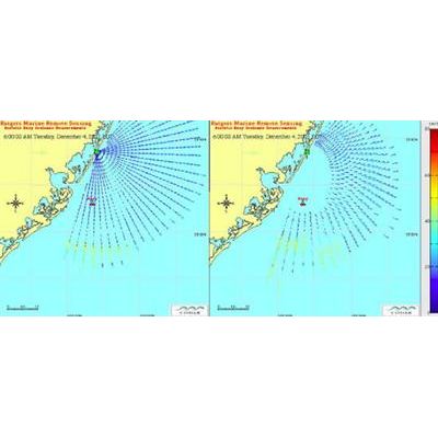
This kit can generate autonomous SeaSonde antenna pattern data using Doppler echoes from passing vessels as a signal source and their AIS transponder data for a reference bearing. The automated output is useful in system calibration, routine system monitoring and maintenance for maximizing quality assurance of your SeaSonde data products. Antenna pattern data is collected in real time on the site and updated pattern data is produced at user selected rates and based on the level of local vessel traffic, which may vary by direction or time. This technology may reduce the need for additional transponder measurements, or be used to identify times when a new transponder measurement is necessary.
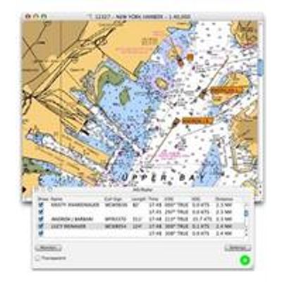
SeaSonde - Model SSDP-CS-UPEX - Combine Site Suite
SSDP-CS-UPEX is the upgrade of an existing (previously purchased) SeaSonde Combine Suite basic license to Extended Version so that it can interact with up to 24 SeaSonde Remote Units. No hardware is included.
SeaSonde Portus - Marine Information System Software
PORTUS is a state-of-the-art, multi-user, web-based Marine Information System that boosts visibility and value of your oceanographic and meteorological data. PORTUS provides real-time and historical environmental data management, analysis, visualization and internet-based distribution. A wide variety of environmental data whether measured or modeled are made accessible through a familiar Google MapsTM interface. Ability to integrate data from different models of HF radar systems. Special attention is paid to get the most out of CODAR SeaSonde® HF radar data.
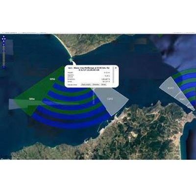
SeaSonde - Model SSDA-ES100 - Multi-Static Data Processing Software Package
The multi-static data processing software package enhances the conventional backscatter "Current" tool that produces radial velocities from SeaSonde echoes, by enabling processing of sea echoes from separated transmitters. The result is a set of bistatic elliptical files for each set of echoes that originate from synchronized transmitters included within radar range. For example, if three transmitters are within range and synchronized -- as well as that station`s transmitter -- then four sets of current scalar-velocity estimates are produced. These follow the same LLUV formats (latitude/longitude/u/v) as standard backscatter radials, so that subsequent algorithms will recognize and utilize them, including combining tools to get total vector maps.