
FarmingIT services
FarmingIT - Topographic Mapping Services
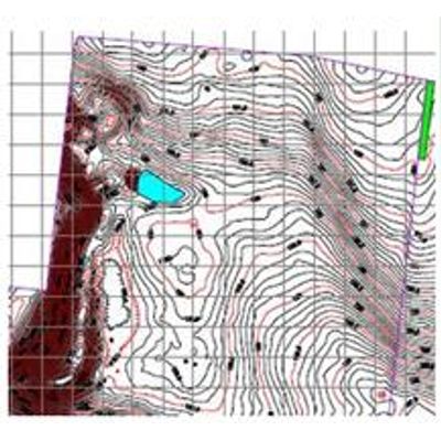
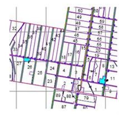
FarmingIT offer a range of topographic mapping services, tailored to your specific needs. Using the most accurate survey grade, dual-frequency RTK GPS system, we are able to maintain centimetre accuracy. Unlike traditional surveying techniques we are able to do this without the need for line-of-sight access to our base station. This make working over large properties, around hills, and behind trees and buildings much more efficient.
Ssset Mapping Services
From whole farm asset maps, to just recording the location of a new power cable, water pipe or ag drainage line, we are able to record it quickly and easily, with centimetre accuracy. We can even come back in the future to locate previously mapped buried services.
FarmingIT - Yield Mapping Services
Do you want to create yield maps from your yield monitor, but don`t have time to learn how to operate the software? Does your harvest contractor have the ability to give you yield data, but you don`t know what to do with it? If your answer is `yes` to either of these questions, then FarmingIT have the solution.