- Home
- Companies
- GecoSistema Srl
- Products
GecoSistema Srl products
Climate Tools
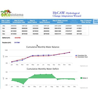
Model HyCAW - Hydrological Climate Adaptation Wizard
Changes in temporal and total water availability due to hydrologic and climate change require an efficient use of resources through the selection of the best adaptation options and water saving strategies. HyCAW tool supports the assessment of different adaptation strategies to cope with changes in temporal distribution and total amount of water availability. The Wizard embeds knowledge of monthly distribution of available surface- and groundwater resources at a site under present and future (climate change) scenarios
Cloud Web-Modeling Tools
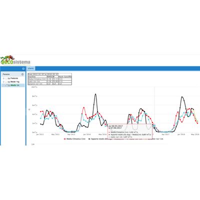
Model SmartRIVER - Open-Source Artificial Intelligence Web Service for Effective Water Resources Forecast And Management
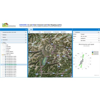
Model AWESOME - Innovative Cloud-Web-Based Platform For On-Line Simulation
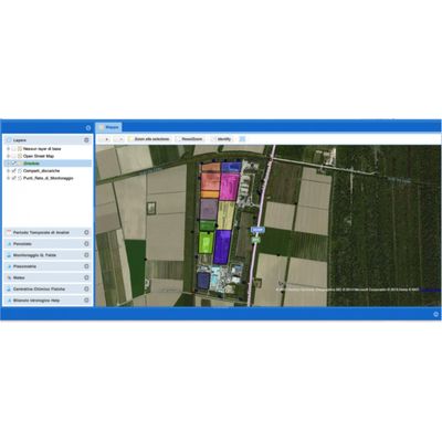
Model LandRISK - Cloud Web-Mapping DSS for Data Management System
LandRISK is a cloud web-mapping DSS for data management, statistical analysis, near-real time hydro-geological modelling for assessing the groundwater quality and risk for human and environment related to a waste Landfill and contaminated sites. LandRISK allows the contaminated site manager and the control Authorities to obtain real-time information about the status of the water quality at the monitoring points. In addition, the numerical models of groundwater flow are able to provide updated information on the hydrodynamic conditions on the site and possibly support the manager in the interpretation of potential violations of the limits of the guard at the monitoring points. The DSS is developed in a Web-GIS using open-source software (Open Layer) and is accessible through a common web-browser without the need to install specific software, the service is available on Cloud Amazon technology can provide computing power and adequate speed for the return to the user in real time.
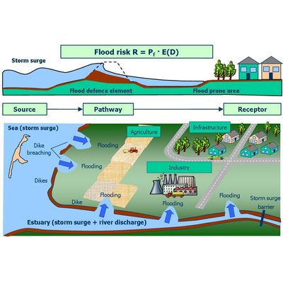
Model MARASMA - Web Map-Based Sdss for Costal Risk Assessment And Mitigation Planning
The European Directive on the assessment and management of flood risk reinforces a risk based approach as being fundamental to good decision making. The concept of risk however is only one component of good flood management which demands integration across sectorial interests as well as spatial and temporal domains. The primary objective of MARASMA_DSS is to provide an integrated Web_GIS DSS for mapping coastal flooding and planning mitigation measures which addresses social, economic and environmental aspects in a multicriteria scheme. The Web_tool support an assessment of the change in risk due to a range of scenarios (climate change and subsidence) and selection of the most appropriate intervention measures from an available portfolio of engineering, ecological and social measures.