
- Home
- Companies
- Geomatrix Ltd
- Products
- Land Products - Magnetic
- Land Products - Multi Sensor Platforms
- Land Products - Seismic - Seismic Exploration Systems
- Land Geophysical Equipment - Borehole Logging
- Land Geophysical Equipment - Electromagnetic
- Land Geophysical Equipment - Magnetic
- Land Geophysical Equipment - Radiometric
- Land Geophysical Equipment - Seismic
- Land Products - Electromagnetic - Time Domain Systems
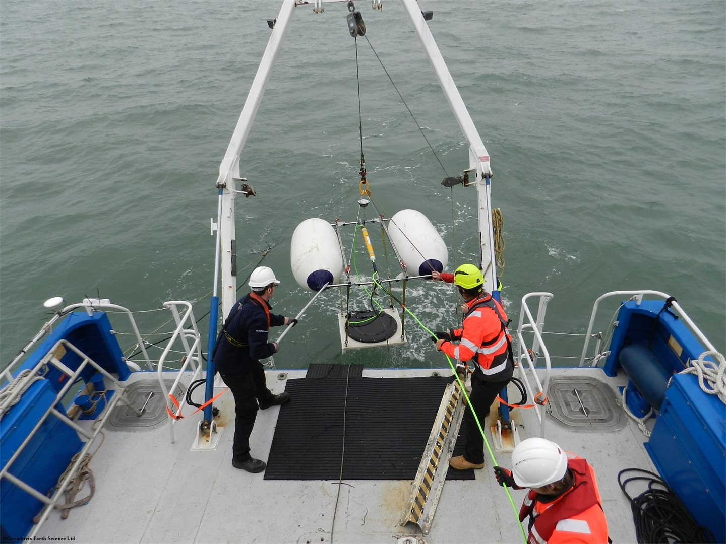
- Marine Products - Magnetic
Geomatrix Ltd products
Land Products - Magnetic
Geomatrix - Six Way Concatenator
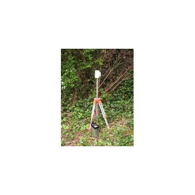
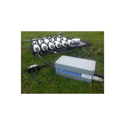
The Geomatrix Earth Science Ltd Six Way Concatenator has been specifically designed to enhance the functionality of the Geometrics G-823, 862, 880 & 882 magnetometers. The Geomatrix Six Way Concatenator offers a reliable, easy to use, solution for managing sophisticated Geometrics caesium sensor arrays.
Land Products - Multi Sensor Platforms
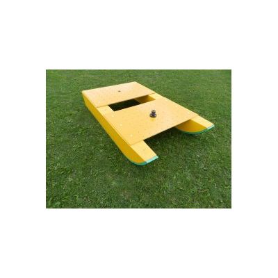
Geomatrix - Multi Sensor Platform Sledge
As geophysical instrument manufacturers incorporate the ability to transmit measurements in real time to external media devices it is becoming easier to mount these instruments onto platforms designed to be towed by a vehicle, ultimately increasing productivity. However, due to the stresses exerted by towing, few offer a durable platform which does not have a geophysical signature.
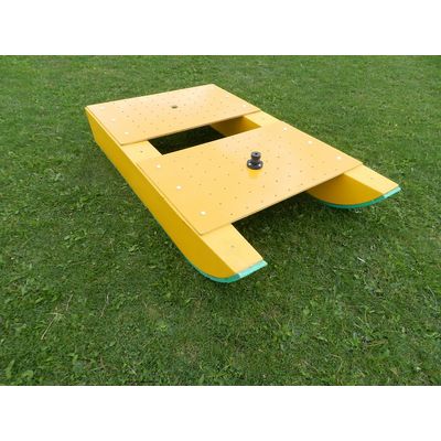
Geomatrix - Model MSP Sledge - Multi Sensor Platforms
As geophysical instrument manufacturers incorporate the ability to transmit measurements in real time to external media devices it is becoming easier to mount these instruments onto platforms designed to be towed by a vehicle, ultimately increasing productivity. However, due to the stresses exerted by towing, few offer a durable platform which does not have a geophysical signature. The Geomatrix Multi Sensor Platform (MSP) is a versatile nonmagnetic, nonconductive sledge designed to provide a stable platform for acquiring geophysical data.
Land Products - Seismic - Seismic Exploration Systems
Geomatrix - Model Landstreamer - Seismic Exploration Systems
Geomatrix Landstremers are based around the L1 kit supplied by GeoStuff. From many years of experience supporting a lease pool of geophysical instruments we understand the lengths needed to produce a rugged and durable landstreamer which can be relied upon. Suitable for MASW, refraction or reflection surveys our land streamers help to improve productivity without compromising data quality.
Geomatrix - Model GP111 - Smart GPS Protector for Seismic Exploration Systems
The GP111- Smart GPS Protector (Fig.1.) is an interface box which allows the user to collect GNSS alongside wireless seismic data by using systems such as the SmartGPS-3TP and a Geode seismograph, via remote triggering. This digital interface box enables the user to aquire, monitor and retrieve GNSS and seismic data at a 1pps pulse rate using the RS422 serial port. The seismic data acquisition can be triggered using the interface box which uses a master clock signal from the GPS receiver and the RS-232 serial port output; all data can be exported in ASCII format.
Land Geophysical Equipment - Borehole Logging
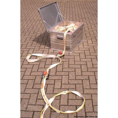
Borehole Probes
Two series of borehole probes can be supplied, Stand Along Probes or Quick Link (QL). As the name dictates, stand-alone logging probes are designed around a particular sensor or complimentary sensors and cannot be adapted. The Quick Link series enables the operator to tailor a particular sensor array to meet project requirements. Quick Link probes can be used independently or stacked to form particular tool strings. Quick Link tool have superseded the poly-Series slimline tools. Please contact sales@geomatrix.co.uk for more information.
Land Geophysical Equipment - Electromagnetic
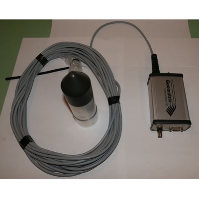
TerraPlus - Model KT-10 - Handheld Magnetic Susceptibility and Conductivity Meters
Through recording the magnetic susceptibility & conductivity of exposed bedrock it is possible to construct a comprehensive infield assessment of the changes to geochemical and mineralogical composition along outcrops, thus ensuring complex lenses, enclaves and other bodies are identified and mapped correctly. The Terraplus KT-10 magnetic susceptibility & conductivity meters are tailored towards characterising rock samples or drill cores by offering interactive metadata and QC functions to aid maintain data quality throughout a survey.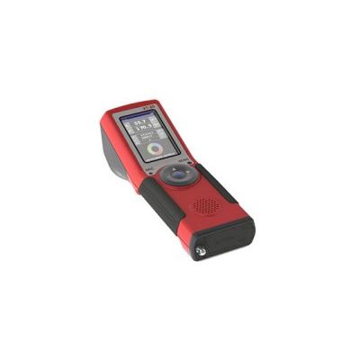
TerraPlus - Model KT-20 - Handheld Magnetic Susceptibility, Conductivity and Density Meters
The KT-20 offers a complete handheld solution for mineral exploration, geological sampling, core logs or soil science. The instruments ability to record Magnetic Susceptibility, Conductivity/ Resistivity, Density, Induced Polarisation and Geospatial Position enables the Exploration Geophysicists to map and characterise samples effortlessly. The KT-20 supports a number of different sensors in order that the instrument can be optimise for a particular application. Both the coil shape and frequency can be varied by changing the sensor.
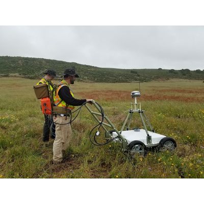
Geometics - Model MetalMapper 2x2 - Advanced Transient Electromagnetic (TEM) Instrument
MetalMapper 2x2 is the most advanced Transient Electromagnetic (TEM) instrument available for Unexploded Ordinance (UXO) detection. Through analysing the 3D EM decay curves of buried metallic targets the instrument permits an operator to differentiate between intact UXO, fragmented shrapnel and metallic debris. This is achieved through illuminating a buried object from different locations and recording the three-axis electromagnetic decay. The instrument consists of four 35cmx35cm transmitter loops, producing 30A-m2 magnetic moment, positioned in a two by two array. Located in the centre of each transmitter coil is a three-axis receiver. Each transmitter is sequentially triggered and the decay curves from each receiver coil recorded, producing in total 48 decay curves.
Land Geophysical Equipment - Magnetic