
- Home
- Companies
- GeoModel, Inc.
- Services
GeoModel, Inc. services
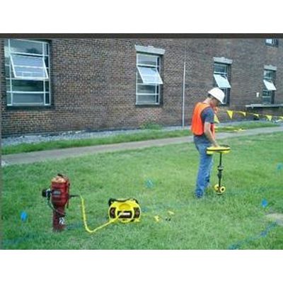
Utility Location Surveys Services
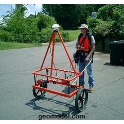
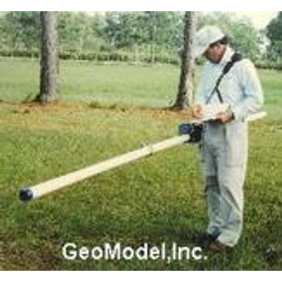
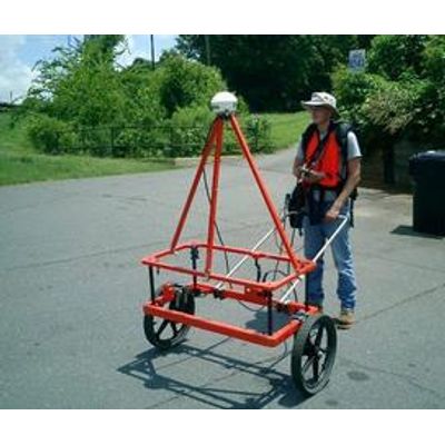
GeoModel, Inc. has over 25 years of experience locating underground utilities nationwide. GeoModel, Inc.’s professional utility location experts use only the latest equipment and methods to locate underground utilities. These utility location methods include ground penetrating radar (GPR), electromagnetic conductivity (EM) and frequency location. GeoModel, Inc. is known for locating utilities and pipelines that other locating companies cannot.
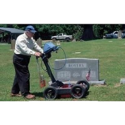
GeoModel - Cemetery Mapping and Grave Mapping Services
GeoModel, Inc. can locate known (marked) and unmarked graves in cemeteries using Ground Penetrating Radar (GPR). During the grave detection survey, the located graves are marked on the ground with paint, and can be subsequently plotted on a map of the cemetery (called grave mapping or cemetery mapping).
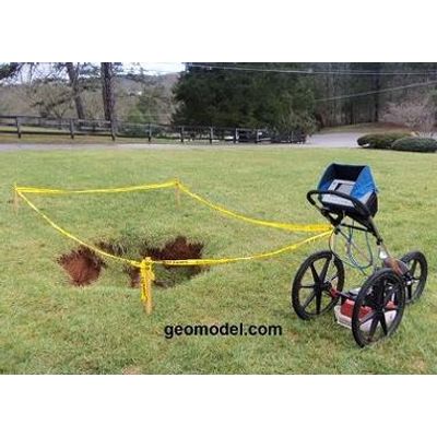
GeoModel - Sinkhole Detection and Void Detection Surveys Services
GeoModel, Inc. conducts sinkhole detection and void detection surveys throughout the United States. GeoModel, Inc. uses ground penetrating radar (GPR) to locate subsurface sinkholes and detect voids. GeoModel, Inc. only uses licensed Professional Geologists with Master’s degrees in Geology to conduct each void or sinkhole location survey.
GeoModel - Underground Storage Tank Detection and Buried Drum Detection Services
Underground storage tanks (USTs), such as steel fuel tanks, or buried drums can be detected using a range of geophysical tools, including metal detection, magnetometers, line tracing, electromagnetic conductivity (EM), time domain EM, and ground penetrating radar (GPR). GeoModel, Inc., is not only equipped with a complete selection of necessary underground storage tank detection tools, but has the training and expertise to accurately use them.

GeoModel - Geology, Bedrock and Geologic Hazards Surveys Services
Before you develop a site, you need to know what types of geological hazards may lurk underneath the ground. GeoModel, Inc.’s professional geologists specialize in conducting geological surveys and geophysical surveys to map out the geology of a site, including depth to bedrock, and delineate corresponding hazards.
GeoModel - Landfill Detection and Burial Trench Delineation Survey Services
Using a variety of geophysical survey methods, GeoModel, Inc. can conduct landfill detection surveys to locate and delineate the extent of a landfill up to 50 feet deep.
GeoModel - Concrete and Rebar Inspection Services
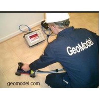
When you need to know what is embedded within concrete, and/or the condition of the concrete, GeoModel, Inc. can conduct a real-time concrete inspection survey. Using ground penetrating radar (GPR), we can locate rebar, pipes, dowels, and plastic, and fiber optic conduits. Our concrete inspection survey can also detect voids within concrete slabs and under concrete slabs. We can scan concrete as thick as 12 to 18 inches and can report on the relative thickness, deterioration, and structural problems.
GeoModel - Archaeological and Environmental Studies Services
GeoModel, Inc. conducts archaeological site studies and environmental impact mitigation surveys using ground penetrating radar (GPR) and electromagnetic conductivity (EM).
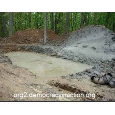
GeoModel - Brine Pits Survey Services
A brine pit is a surface impoundment used to store or evaporate water used in the drilling, mining, or processing industries. The brine pit water may contain salts, minerals, or toxic substances that can lead to brine contamination in groundwater. After the brine pit is no longer used, it is sometimes covered over with dirt or a liner. Once covered or buried, the brine pit location is difficult to detect visually.