Geosoft Global
- Home
- Companies
- Geosoft Global
- Services
2 services found
Geosoft Global services
Geospatial
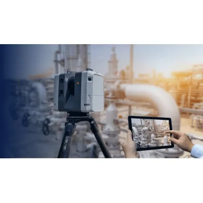
Geosoft - 3D Laser Scanning and Modeling Services
Geosoft specializes in 3D laser scanning services, offering precise ground-based and air-borne solutions for projects requiring field measurements. Utilizing advanced 3D laser scanners, we swiftly capture and document the spatial locations of numerous points, providing high accuracy. Our services include the coordination of target profile surface data to generate three-dimensional image models of structural and piping configurations for both offshore and onshore applications. These comprehensive 3D models are particularly suitable for various industrial site assessments, ensuring detailed and reliable information for engineering and inspection purposes. Geosoft's expertise in 3D laser scanning and modeling ensures that clients receive accurate spatial data and actionable insights for their projects.