

- Home
- Companies
- Geosoft Sp. z o.o.
- Software
Geosoft Sp. z o.o. software
Geological and Geotechnical Software
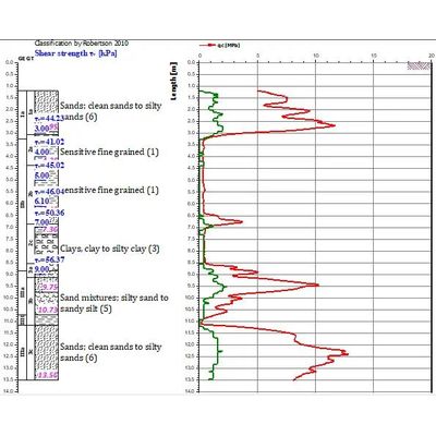
Geosoft - Model CPT-pro - CPT Test Interpretation Software
CPT interpretation software CPT-pro is a multi-module program for comprehensive analysis, interpretation and presentation of cone penetrometer test CPT / CPTU, DMT dilatometer test and other field tests such as FFD and EC. Methods of CPT data interpretation along with formulae and graphs have mostly been extracted, with the knowledge and consent of the authors, directly from the monograph of: Lunne, T., Robertson P.K. and Powell J.J.M. Cone Penetration Testing in Geotechnical Practice. Published by Blackie Academic & Professional. 1997.
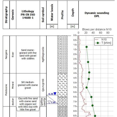
Geosoft - Model Geo DB - Geological and Geotechnical Database
GEO DB is a geological and geotechnical database that compiles data from drilling, field tests and laboratory studies. GEO DB is equipped with a set of analytical tools, advanced statistical methods and documentation tools (borehole logs, reports, charts, sections, maps, etc.).
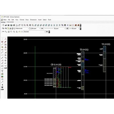
Geosoft - Model CPT-CAD - CAD Graphics Software
Geological cross section and geotechnical cross section can be made in the CPT-CAD program. It contains a set of tools enabling automatic generation of geological and geotechnical cross sections and maps based on information contained in interpreted CPTU soundings and information contained in the geological and geotechnical database GEO DB.
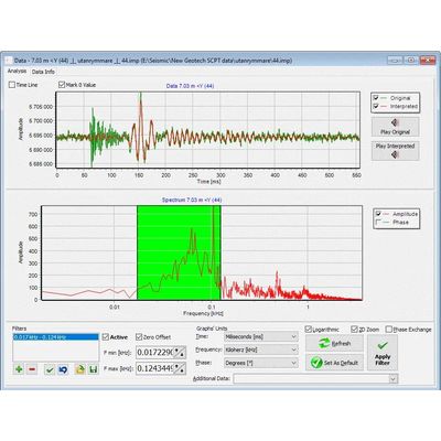
Geosoft - Model SEISMIC-pro - Geotechnical Software
SEISMIC-pro software allows User to filter, analyze and interpret raw SCPT data generated in seismic test, as well as to generate reports with results of analysis. Implemented editor of mathematical formulas (under construction) allows User to generate own interpretation formulas and calculate geotechnical parameters. The current status of analysis can be saved in project, so the analysis of results saved in one hole (sometimes 30-40 tests) can be divided into few phases and continued any time. Presentation of the seismic wave spectrum allows for verification of the correctness of the recorded amplitude and selection of the optimal filtering frequency range.
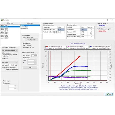
Geosoft - Model VANE-pro - FVT Data Interpretation Software
VANE-pro is designed for FVT data interpretation and presentation of data generated by electric VANE test apparatus. Compatible with Geotech and Geomil files.