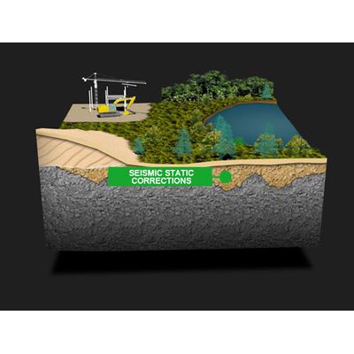
Poorly-defined seismic low velocity zones can adversely affect the clarity and interpretability of seismic profiles. Traditional solutions of up holes and refraction statics often either result in significant interpolation between disparate up holes sites or inaccuracies due to incorrect refraction picking. Recently, extremely long-range radar has shown promising results in desert environments at mapping both the base of tall dunes and the underlying weathered zone as well at high speed and low cost.

Groundradar Inc.
- Home
- Companies
- Groundradar Inc.
- Services
5 services found
Groundradar Inc. services
Resource Exploration

UltraGPR - UltraGPR for Nickel Laterite Exploration Services
Groundradar specializes in ground penetrating radar (GPR) applications specifically tailored for nickel laterite exploration and resource definition. Their staff have undertaken extensive radar projects on more than 60 deposits across diverse environments such as the Amazon jungle and the mountains of Madagascar. Groundradar's radar technology offers continuous imaging of weathering profiles, essential for mapping the extremely variable depths typical of lateritic environments. This approach addresses limitations in traditional drill-based exploration, which can miss abrupt horizon changes due to economic grid spacing constraints. Groundradar employs a robust statistical method for mineral resource estimation, combining accurate radar-mapped volumes with strategically placed boreholes for verification and grade confirmation. The UltraGPR instrument, designed for deep imaging, features advanced radar technology that surpasses commercial GPR systems in penetration depth, accuracy, and ease of use. Achieving depths of up to 75 meters in lateritic profiles, UltraGPR offers high-resolution imaging while simplifying field deployment with a single tube design and Bluetooth-enabled communication. It is entirely waterproof and operable in challenging terrains, controlled via mobile devices for data acquisition and parameter management.
Bauxite Services
A resource estimate consists of a statement of the tonnage of the resource and its grade: $Gross revenue = Grade X Tonnage. In bauxites, reliable tonnage calculations depend on reliable volume calculations. When thickness is more variable than grade, reliability of resource estimates may depend primarily on thickness estimates. Traditional thickness estimation is derived from regularly spaced drilling that is seldom able to accurately model the ore surfaces. UltraGPR is capable of accurately identifying the bottom of ore with more detail than drilling and at a fraction of the cost. The result is a more accurate volume calculation.
Geotechnical
Groundradar - Void Detection Services
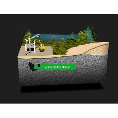
UltraGPR has been effectively applied in the detection of cavities, particularly in limestone formations or open pit mines. Utilizing advanced Ground Penetrating Radar (GPR) technology, UltraGPR not only identifies cavities but is also proficient in imaging abandoned tunnels at depths exceeding 40 meters. The technology enhances depth penetration capabilities and offers cost-effective survey options, surpassing traditional geophysical methods like microgravity in challenging terrains. Groundradar's MineVue, an advanced armored low-frequency radar system, further exemplifies these capabilities by successfully detecting active and abandoned mine areas at depths of over 32 meters. This has proven particularly valuable in recent deployments across Asia, Africa, Australia, and South America. Moreover, MineVue holds the distinction of being the leading ATEX-approved GPR system suitable for long-range operations in coal mines, ensuring both efficiency and safety in geotechnical applications.GPR Processing Services
For large projects, Groundradar offers custom long-range GPR instruments to qualified clients at no-cost to enable them to acquire their own data. Groundradar then receives the data on a nightly basis and edits, processes, interprets and models it with a 24 hour turn-around time. Groundradar firmly promotes the belief that GPR is only useful where the raw data clearly shows the targets or horizons in question. Our editing, processing, interpretation and modeling only position in 3D and enhance interpretability of the data. Contrary to how GPR is generally used, Groundradar does not produce cross-sections with wiggly lines which require a mystical radar expert to interpret. Our sections and 3D models are clear and targets should be recognisable by anyone.