
IDS GeoRadar - part of HEXAGON products
Ground Penetrating Radar
Opera - Model Duo & uNext - Ground Penetrating Radar System
100% manufactured by utility market leader IDS GeoRadar, the Opera Duo is a compact, easy to transport and deploy ground penetrating radar leveraging robustness, data quality and intuitiveness for unparalleled utility location and mapping. Opera Duo is available in two versions:
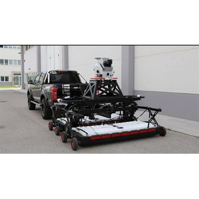
Stream - Model C - Ground Penetrating Radar for Real Time Underground Utility Mapping
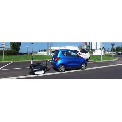
Stream C is the compact array solution for real-time 3D mapping of underground utilities and features. Thanks to the increased level of accuracy, provided by a massive antenna array, Stream C is able to detect pipes and cables automatically. Daily use of Stream C is aided by ergonomic features including electronic ride height adjustment, options to tow manually or with a small vehicle, and a motor assisted drive wheel. Stream C is available in both Basic and Advanced configurations.
Stream - Model EM - Ground Penetrating Radar for Utility Locating and Mapping
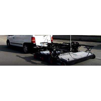
Stream EM is the multi-channel ground penetrating radar solution dedicated to utility locating and mapping. The solution has been conceived to cover tens of hectares/day, obtaining the best utilities detection quality thanks to 40 separate channels. The solution includes double polarized (VV and HH) antennas to cover wide road surfaces. The system maintains the same maximum data collection speed, 15 Km/h, with only longitudinal scans for both longitudinal and transversal pipes detection.
Pegasus - Stream - Model EM - Ground Penetrating Radar System
Stream EM in accompaniment with the Leica Pegasus:Two offers a solution that provides an integrated hardware platform for extensive 3D mapping of both underground utilities and surface features in only one scan.
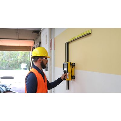
IDS - Model C-thrue - All-In-One Ground Penetrating Radar (GPR)
Easy-to-use and robust GPR solution to improve safety before cutting or drilling into concrete structures. See thru concrete structures and reveal true data that lead to optimal decision-making. C-thrue is an all-in-one Ground Penetrating Radar (GPR) for accurate scanning and real time analysis of concrete structures. Construction and service companies as well as civil and structural engineers can now improve the way they locate rebars, voids, post-tension cables, cavities, conduits, and any other objects buried in the structure before cutting or drilling into the concrete.

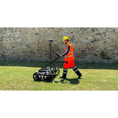
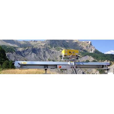
IDS - Model Stream UP - Multi-Channel, Multi-Frequency, Double-Polarized and Lightweight GPR System
The easiest way to capture underground utility assets. Stream UP is an innovative multi-channel, multi-frequency, double-polarized and lightweight GPR system dedicated to utility mapping on extensive areas that facilitates the whole process (before, during and after data acquisition). Stream UP is a GPR system able to operate in urban environment without slowing down the traffic (up to 150 km/h, with a suggested acquisition speed of 60 km/h). The system can be carried even on the same vehicle used for the acquisition thanks to its compactness that increases its transportability.
IDS - Model Stream DP - Multichannel GPR Array Solution
The ultimate GPR array solution with EsT technology for the highest depth performance in utility mapping. Maximum depth, high resolution and versatile design for superior productivity in underground surveys. Stream DP is the revolutionary multichannel GPR array solution for real-time 3D mapping of underground utilities and features that overturns the state-of-the-art in underground surveys. Featuring the new radical Equalized scrambled Technology - EsT by IDS GeoRadar, Stream DP brings underground assets detection to the next level: the deepest one. This ground penetrating radar offers unmatched performance maximizing asset detection to a deeper range compared to any other solution available on the market.
Interferometric Radar
RockSpot - Radar Systems
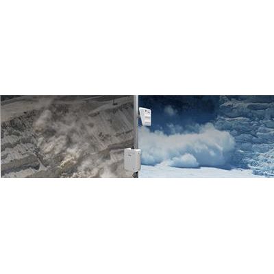
RockSpot is an innovative radar system able to locate, track and alert on rockfalls, avalanches and debris flows in real time. This small yet powerful radar picks up tiny falling rocks at great distances long before the human eye can see them. RockSpot is the industry’s first end-to-end solution able to trigger alerts on rockfalls and other collapse events, filling the gap in critical monitoring. Each single rockfall event is detected in real time and immediate alerts issued to geotechs and working crews.
IBIS - Model FL - 2D Monitoring Interferometric Radar for Movements and Displacements
The IBIS-FL interferometric radar is a highly innovative technology for 2D monitoring of displacements and movements in slopes and structures. Required to prevent or forecast natural disasters that could affect human lives, monitoring of terrain movements (e.g., unstable slopes, landslides, glaciers) is an increasingly important task for today’s geotechnical experts.
IBIS - Model FS - Remote Monitoring Microwave Interferometry Based Radar System for Structural Movements
A microwave interferometry based system for remote static and dynamic monitoring, IBIS-FS interferometric radar is used on bridges and other structures including buildings, historical monuments and towers.