

Integrated Geo Instruments & Services Private Limited products
Geophysical Instruments
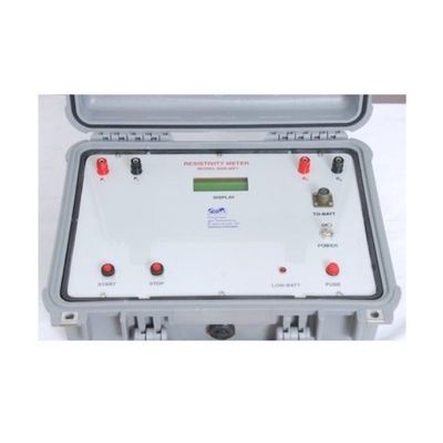
Integrated Geo - Model SSR-MP-ATS - Signal Stacking Resistivity Meter
We bring forth a comprehensive range of Resistivity Meters Item Code: SSR-MP-ATS. The IGIS signal stacking based Signal Enhancement Resistivity Meter Model SSR-MP-ATS is state of art microprocessor based data acquisition system. The instrument design incorporates several innovative features and advanced techniques of digital circuitry to make it a reliable Geophysical tool providing high quality data useful for mineral and groundwater exploration and any other Geophysical applications. The SSR-MP-ATS sends the entire current into the ground without wasting power for constant current generation thus increasing the signal strength to probe deeper layers.
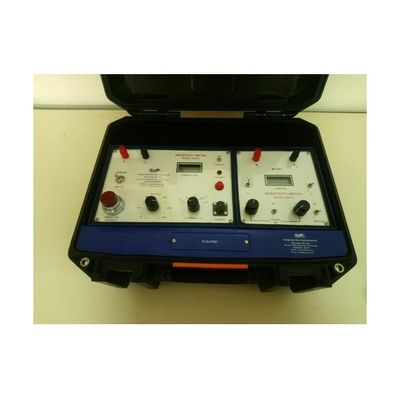
IGIS make - Resistivity Meter
The instrument design incorporates several advanced techniques of digital circuitry to make it reliable Geophysical tool that provides high quality data useful for all types of mineral and groundwater exploration research etc. The SSR-MP1 sends the entire current into the ground without wasting power for constant current generation thus increasing the signal strength to probe deeper layers. The advanced design of SSR-MP1 Resistivity Meter achieves excellent depth penetration with relatively low power transmission. It utilizes the signal stacking up to 99 successive readings to achieve the beneficial signal enhancement. In the presence of random (non-coherent) earth noises, the signal to noise ratio of the SSR-MP1 measurement will be enhanced by N where N is the number of individual readings. Hence SSR-MP1 Resistivity meter can be used for depths of up to 600m under favorable geological conditions.
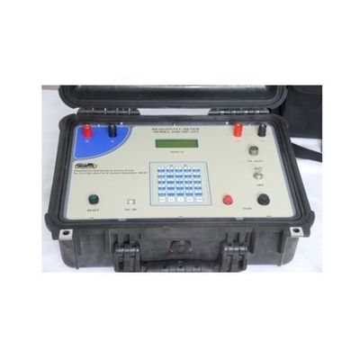
IGIS make - Model DDR3 - Resistivity Meters
The DDR 3 Resistivity Meter is a specialized version of IGIS Resistivity meters designed for use in Resistivity surveys up to about 200m depth. It utilizes rechargeable batteries as power source to energize the ground thus eliminating the necessity of using the relatively expensive dry cells. The equipment consists of two separate comportment-one for reading the current (G-Unit) and the other for directly reading the resistance/the potential (M-Unit), both housed in a single box. The equipment, powered by a 24V rechargeable battery can send highly stabilized currents up to 200 mA and read the resulting potential with a 100 micro volts resolution or ground resistance directly with 50 micro ohms resolution.
EOS Positioning Systems

Model Arrow 100 GNSS - Receiver
The Arrow 100 GNSS Receiver was designed specifically with GIS and mapping users in mind. This receiver squeezes more accuracy from GNSS constellations and free SBAS corrections than any other receiver in the world. Thanks to its patented technology, you can use the Arrow 100 under trees, around buildings, and in rugged terrain where other receivers will fail to deliver. And thanks to real-time corrections processing in the field, you no longer have to spend time post-processing your data. When having GPS is just not enough, the Arrow 100 steps in to provide at least 24 more satellites from the remaining global constellations (i.e., GLONASS, Galileo, BeiDou). When its all-constellation support is combined with free SBAS corrections (in most regions of the world), the Arrow 100 can provide 60 cm real-time accuracy.
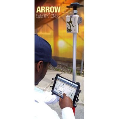
Model Arrow Gold GNSS - Receiver
The Arrow Gold GNSS Receiver is the first high-accuracy iOS, Android, and Windows Bluetooth GNSS receiver to implement all four global constellations (GPS, GLONASS, Galileo, BeiDou), three frequencies (L1, L2, L5) and satellite-based RTK augmentation. The Arrow Gold works with all apps that run on iOS, Android, and Windows devices. It also supports all planned global satellite constellations as well as all planned signals, giving it an awesome return on investment that will serve you well into the next decade and beyond.

Model Arrow Lite GNSS - Receiver
The Arrow Lite GNSS Receiver was designed specifically with the North American GIS and mapping community in mind. It squeezes more accuracy from the GPS constellation and free SBAS corrections than any other receiver on the market. Thanks to patented technology, the Arrow Lite works under trees, around buildings, and in rugged terrain. It even works where other receivers fail to deliver. Like all Arrow Series receivers, the Arrow Lite provides real-time submeter corrections in the field. So there no more post-processing. Get higher accuracy and greater productivity from the unmatched value of Arrow Lite.
TwoNav Handheld GPS Devices
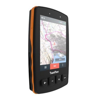
Twonav - Model Trial2 - GPS Devices
Improve your navigation with and get ready before you leave, knowing the terrain and difficulty level ahead. Innovative design & 36 h autonomy Ergonomic and modern design with a GorillaGlass capacitive screen. Over 36 hours of autonomy. GPS signals and Galileo & Glonass Acces 3 positioning networks, which are integrated within the GPS device, so you can enjoy a faster and more efficient connection anywhere in the world. Extra Storage, More Maps & Routes Increase the storage capacity of your Aventura 2 GPS with a microSD card, so you can load extra maps and routes.
Laser Technology
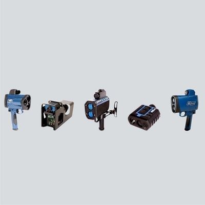
Laser Technology USA - Traffic Speed Gun
From speed enforcement to crash scene investigations, LTI`s laser-based equipment has been used for years by law enforcement agencies around the world. Our lasers are also used for tailgating enforcement, photo/video-based speed enforcement, statistical data collection and general measurements for SWAT and HAZMAT. Lidar, which stands for light detection and ranging, is truly our specialty. LTI revolutionized speed enforcement with the introduction of the very first laser speed device called the LTI 20/20 Marksman. This was a major breakthrough for the law enforcement community because they were now able to pinpoint a particular vehicle in dense traffic and had equipment that was unaffected by radar detectors. Speeding has always been the leading cause of accidents and deaths on our highways, which makes us proud to have developed technology that may deter habitual violators from speeding. Simply put, our technology ultimately helps save lives.