

- Home
- Companies
- IVU Umwelt GmbH
- Software
IVU Umwelt GmbH software
FloodFILL - GIS-Based Flood Modelling
The hydrologic model floodFILL is an easy-to-use system for calculation the spatial and temporal extent of an inundation in a floodplain.
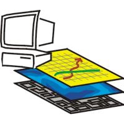
Geospatial Integration Services
IVU Umwelt will integrate your models and our models in geographical information systems (GIS). This approach is suited to the spatial reference in data used for environmental planning and opens up new possibilities for you in analysis and display. As an ESRI business partner and MapInfo partner, IVU Umwelt offer professional services and efficient integration of GIS ArcView and MapInfo.
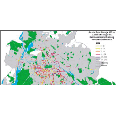
Emission Tracking System
Dynamic emission inventory: The creation and regular updating of emission inventories is a standard task in maintaining air quality. The sources of emissions affected are mainly immobile geo-objects (e.g. streets, chimneys, residential areas) that can be well administered within a geographical information system (GIS). Emission-determining factors (e.g. traffic volumes, exhaust temperature, fuel), on the other hand, vary with time. But they too, as a rule, have a geographical reference (e.g. the position of the counting/measurement site, a town"s population).
Environmental Data Analysis
We have been carrying out statistical analyses for many years with S+, IMSL, RATS and TSP, among others.
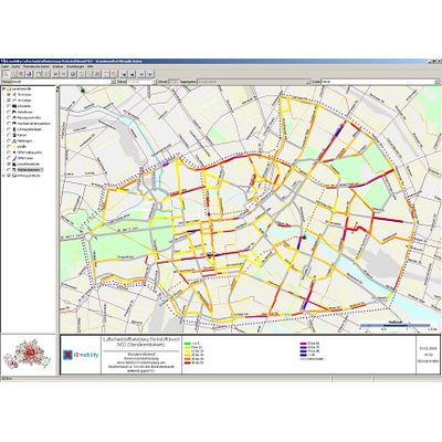
IMMIS - Air Quality Models
Supplying IMMIS to local, regional and federal authorities as well as consulting companies, IVU Umwelt provides a comprehensive program set to evaluate traffic induced air and noise pollution.
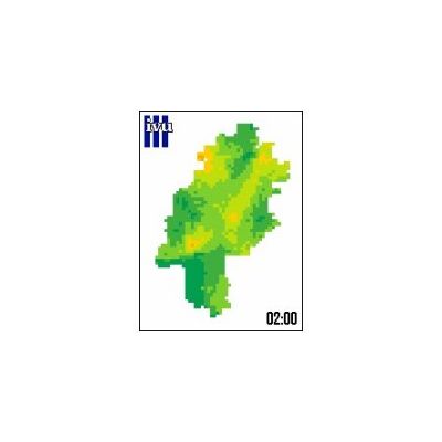
IMMISmt - Online Environmental Monitoring Software
IMMISmt is a real time monitoring system for air pollution and noise. Based on online traffic data, measurements of air quality stations, emission data and weather data, IMMISmt calculates traffic induced emissions, back ground and total pollutant concentrations as well as noise levels within the streets as, e. g., hourly mean values. To do so, IMMISmt combines various models which are validated and widely used in air quality planning.
FLADIS - Air Pollutant Spatial Distribution Analysis Software
FLADIS is a program system for the analysis and visualisation of observational network data. FLADIS calculates the spatial distribution of air pollutants, such as PM10, NO2, NO, O3 and benzene, from point measurements and model simulation runs. It combines interpolated measured data and modelling results for each time step for which data is available.

LimAarc - Noise Calculation With LimA Under ArcGIS
With LimAarc , LimA is embedded in the GIS so you can perform your noise calculations with LimA directly from ArcGIS. Your geo-data (Geodatabase, Shape, ...) are directly available for calculations. There is no need to export the data for calculation purposes, and only one non-redundant set of data remains for further processing. Powerful ArcGIS tools for completing, editing, correcting, and adjusting data are available. You may determine the parameters and start the calculations directly within the GIS. Results are accessible as sets of data and can be used by ArcGIS immediately: e. g. for generation of maps or further processing like merging with other geo-data.
LASarc - Air Pollution Modeling with LASarc ArcGIS Extension
The lagrangian dispersion model LASAT, developed and distributed by Ingenieurbüro Janicke, is being employed by IVU Umwelt GmbH in addition to IMMISnet to calculate pollutant dispersion. LASAT is a complex model for calculating concentrations of air pollutants, taking into account e. g. orography and building structures. It is based on the same algorithms as AUSTAL2000 and is in accordance with the new German directive on air pollution modelling TA-Luft. In studies for large areas with many emission sources, the generation of input data in the required formats is often tedious. The use of a GIS for the automatic generation directly out of GIS-data is practically indispensable. Therefore, IVU Umwelt has developed the ArcGIS-Extension LASarc.