

Lakes Environmental Software software
Air Dispersion Modeling
Lakes Environmental - Model AERMOD View 13.0 - Gaussian Plume Air Dispersion Modeling Software
AERMOD View is Lakes Environmental’s intuitive interface for the U.S. EPA’s preferred air dispersion model, AERMOD. Designed to estimate pollutant concentrations from industrial sources, AERMOD accounts for terrain, building downwash, and meteorological conditions.
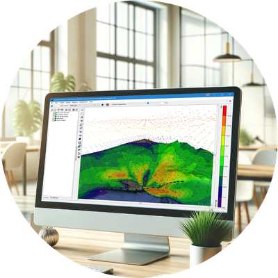
Lakes Environmental - Model Aerscreen View 4.0 - Screening Air Dispersion Modeling Software
AERSCREEN View is a user friendly interface for the U.S. EPA AERSCREEN screening-level air quality model and associated modeling programs. AERSCREEN estimates worst-case impacts of ground level concentrations for a single source by interfacing with the screening mode of the AERMOD model. Scenarios can include simple or complex terrain, building downwash, and NO2 chemistry.
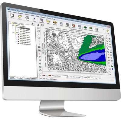
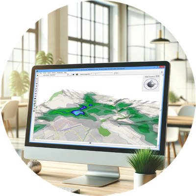
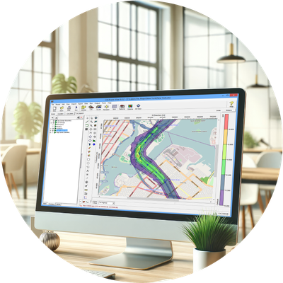
Lakes Environmental - Model AUSTAL View 11.0.27 - Lagrangian Particle Tracking Air Dispersion Modeling Software
AUSTAL View is a graphical user interface for the official German Federal Environmental Agency air dispersion model, AUSTAL. The AUSTAL model was developed according to Germany's air pollution control regulation TA Luft (Technical Instructions on Air Quality).
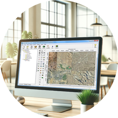
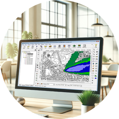
Lakes Environmental - Model CALPUFF View 11.0 - Puff Air Dispersion Modeling Software
CALPUFF View provides a complete graphical solution for the CALPUFF modeling system: CALPUFF, CALMET, CALPOST, and their related pre- and post-processors. All three modeling systems are supported by the interface:
Emissions Management
Lakes Environmental - Ambient Quality Management Information System (AQMIS)
AQMIS, developed by Lakes Environmental Software, is an advanced environmental compliance solution designed to centralize all environmental data within your organization. By automating and streamlining complex tasks, AQMIS helps reduce operational costs and improve efficiency. The system (Ambient Quality Management Information System) consolidates environmental data, modeling tools, analytics, data visualization including mapping, and reporting into one seamless, online platform.
Risk Assessment
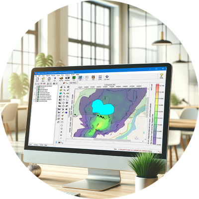
Lakes Environmental - Model EcoRisk View 2.8 - Ecological Risk Assessment Program Software
EcoRisk View is an advanced ecological risk assessment program for conducting a comprehensive multi-pathway ecological risk assessment by simultaneously calculating risk values for multiple chemicals, from multiple sources, at multiple exposure locations.
Lakes Environmental - Model IRAP-h View 5.1.4 - Human Health Risk Assessment Program Software
IRAP-h View is a user-friendly graphical interface for conducting a comprehensive multi-pathway human health risk assessment. It simultaneously calculates risk values for multiple chemicals, from multiple sources, at multiple exposure locations.
Emergency Release
Lakes Environmental - Model SLAB View 5.2 - Emergency Release Dense Gas Modeling Software
This software provides a graphical user interface for the SLAB atmospheric dispersion model, specifically designed for denser-than-air releases. It is an essential tool for predicting hazardous zones and assessing potential impacts of accidental emissions.
Freeware
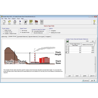
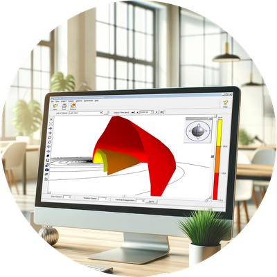
Lakes Environmental - Model SCREEN View 4.0.1 - Screening Air Dispersion Modeling Software
SCREEN View is a user friendly interface for the U.S. EPA screening model, SCREEN3. The SCREEN3 model can be used to estimate worst-case ground level concentrations for a single source as well as concentrations in the cavity zone, and concentrations due to inversion break-up and shoreline fumigation. SCREEN View can model scenarios with simple or complex terrain, with or without building downwash and give results at discrete or automated distances. SCREEN3 is the screening version of the ISC3 model. Preliminary modeling with SCREEN View can remove the need for more complicated modeling, saving you time and resources.