
Lohmeyer GmbH software
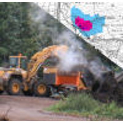
LuWas - GIS-based determination of shipping-related air pollutant emissions along waterways
Program development on behalf of the Federal Institute of Hydrology.
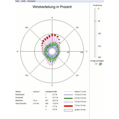
RosePlot - Visualizing and creating meteorological input data for dispersion models
Software for visualizing, editing and creating meteorological input data for dispersion models (AKTerm, AKS). Files of the formats *.aks, *.akt, *.akterm, *.tal, as well as other wind distributions of the formats *.wnd, *.met and meteo.def can be displayed and saved as grafic (*.wmf, *.bmp, *.jpg). With an import module it is possible to convert measurement time series in to the usual data formats AKS and AKTerm. Depending on available data it is possible to convert the stability conditions out of Monin-Obukhov-Lengths, cloud cover data or global radiation data using different algorithms. In addition, RosePlot offers the possibility to directly import uSonic-3 files or meteorological time series published by the DWD (ftp://ftp-cdc.dwd.de/pub/CDC/). In RosePlot is the VDI 3782 Blatt 6 Environmental meteorology - Atmospheric dispersion models; Determination of the dispersion categories implemented according to Klug / Mannier. RosePlot is available in German and English.Software
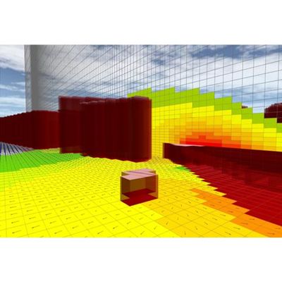
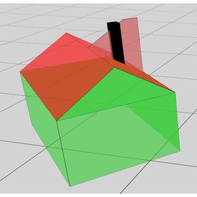
WinMISKAM - 3-dimensional non-hydrostatic climate, flow and dispersion model
MISKAM is a 3-dimensional non-hydrostatic climate -, flow - and dispersion model for the microscale prediction of flow - and concentration fields. It covers in the vicinity of single buildings, as well as streets with adjacent buildings and city quarters. MISKAM was developed by Dr. J. Eichhorn, Institute of Atmospheric Physics, University of Mainz. The model was continuously refined and is now validated on the basis of a large variety of field measurements. WinMISKAM contains a graphical 3D user interface for preparing the input data, running the model and evaluating/visualising the results.

WinAUSTAL Pro - Model AUSTAL3 - Air Pollutant Dispersion Calculation
WinAUSTAL is a user-friendly interface for creating and visualizing the AUSTAL3 input file as well the graphical representation of the computational results. With WinAUSTAL the user is able to examine quickly and conveniently existing and projected facilities as well related to air pollutant dispersion in accordance with the German `Technical Instruction Clean Air` and the German Odour Policy (GIRL).
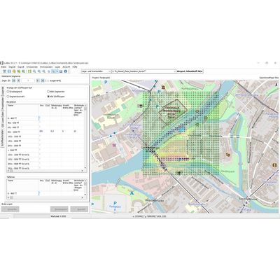
PROKAS Online - Real-Time-Monitoring-System for Evaluating Air Quality in Urban Areas
PROKASOnline is a real-time-monitoring system for the evaluation of the air quality in urban areas. With PROKASOnline it is possible to modelling hourly air pollution concentrations in street canyons considering current traffic, concentration and meteorological measurement data.
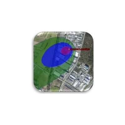
SAMS - System for Calculation of Air Pollutant Concentrations on Accidental Releases
SAMS is a software system for the simulation of the dispersion of air pollutants during and after an accidental release at stationary (fixed installations) or mobile (for example transportation) sources. SAMS calculates the airborne concentrations of the released substance in an area of approx. 30 km x 30 km, taking into account the respective meteorological conditions, and shows isolines and/or grid areas of the concentration as a result. With this information, vulnerable areas can be identified and targeted actions can be taken in a timely manner. SAMS fulfills the requirements for a system for determining and evaluating the pollutant load in the atmosphere in the event of acute releases of substances into the atmosphere in accordance with the VDI 3783 Part 4 guideline and is available in German and English.