

- Home
- Companies
- pDsConsultancy
- Software
pDsConsultancy software
AERMOD - Australian GUI for AERMOD -pDsAUSMOD
AERMOD is a new generation dispersion model. State of the art air modeling concepts;air dispersion based on planetary boundary layer turbulence structure and scaling concepts,including treatment of both surface and elevated sources were included in AERMOD. AERMOD is enjoying its regulatory status since 2006. Many european countries as well as Canada extensively use AERMOD for regulatory purposes.
AERMOD - MetProcessor
Meteorological data processor for AERMOD-Australasian software equivalent to US AERMET. pDsAUSMET is your local meteorological data processor which was developed based on EPA, Victoria’s guidelines “Construction of input meteorological data files for AERMOD”. With pDsAUSMET you can input data in several local formats based on the data availability. As outlined in the EPA, VIC’s guidelines you have to provide.
pDsMap - Utility Software
pDsMAP basically helps you find UTM coordinates for your sources, discrete receptors/site boundaries, building corners etc. In addition you can design a nested grid (high resolution), covering specific area (sensitive residential areas). Furthermore it will help you exclude some specific receptors such as receptors inside the site boundary.
AERMOD - Terrain Processor
Local Topography Processor equivalent to US AERMAP has been built into pDsAUSMOD. It is capable of accepting high resolution local terrain data.
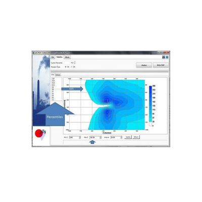
AERMOD - Post Processor
pDsPOST is a local data processor developed based on local requirements. You can input AERMOD .pos file which contains all calculations (hourly) and perform required analysis.
pDsWindRoses Software
pDsWindRoses software basically depicts the frequency of occurrence of winds in each of 16 direction sectors (every 22.5 degrees) and 6 wind speed classes for a given location and time period specified by the users.