

Planet Labs PBC. software
PlanetLabs - Real-Time Satellite Monitoring Spftware
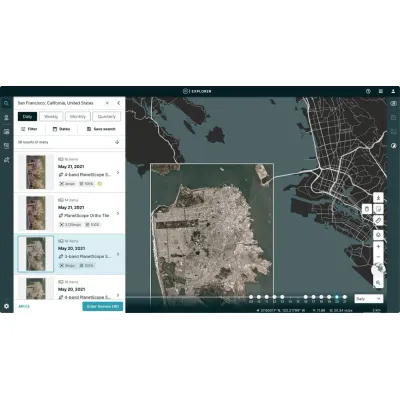
Planet Monitoring leverages a constellation of approximately 200 Dove satellites to deliver high-resolution, continuous and comprehensive global imaging. These satellites, orbiting the Earth every 90 minutes, capture detailed images at a 3.7-meter resolution across four multispectral bands: RGB and Near Infrared, which are invaluable for a variety of applications. The service includes an extensive archive dating back to 2009, capturing over 300 million square kilometers of imagery daily. This persistent monitoring allows for real-time observational capabilities, essential for timely and informed decision-making across various sectors such as agriculture, government, energy, and forestry. By providing pre-processed, analysis-ready imagery through user-friendly Planet APIs, web applications, and GIS integrations, Planet Monitoring seamlessly supports existing workflows. The subscription-based access model ensures scalability and adaptability to diverse needs, from identifying deforestation patterns in Brazil to monitoring oil exploration in remote desert areas. This robust data service empowers organizations to manage assets, track changes, and obtain ground-truth data for enhanced governance and operational efficiency.
PlanetLabs - High-Resolution Imagery Software with Planet Satellite Tasking
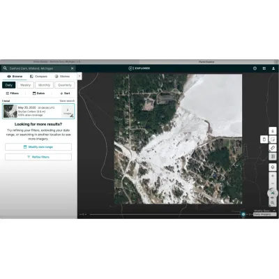
Planet Tasking offers high-resolution, real-time satellite imagery with an impressive 50 cm spatial resolution, enabling organizations to effectively identify blind spots, predict events, and make confident, mission-critical decisions. With around 18 SkySats in orbit, Planet's satellite constellation achieves the highest intraday revisit rates in the commercial sector, capturing actionable insights up to 5-7 times daily. This capability is crucial for sectors such as defense, civil government, forestry, emergency response, and energy infrastructure. Planet's automated Tasking Dashboard simplifies the tasking process, allowing users to autonomously submit, modify, and manage satellite imagery requests. High-resolution data is made available swiftly—within three hours of capture—and integrates seamlessly with existing workflows through Planet's API. Planet's constellation ensures a robust global coverage, capturing an average of 2,400 images per Earth landmass daily, making rapid and accurate insights accessible from anywhere.

Planetary Variables - Hydrological and Biological Systems
Planetary Variables provide continuous, scientifically accurate data to measure changing conditions on the Earth's surface. Utilizing observations from Planet’s own satellite fleet and the wider Earth observations ecosystem, Planetary Variables offer actionable insights into vital aspects such as hydrological and biological systems. These include metrics for water, vegetation, temperature, and forest carbon data. Users benefit from high-resolution data: Soil Water Content at 100 meter and 1 km resolution, Crop Biomass data at 10 meter resolution, Land Surface Temperature at 100 meter and 1 km resolution, and aboveground Forest Carbon quantifications at less than 5 meter resolution. These measurements are derived from a diverse range of sensors like optical, radar, passive microwave, and lidar, combined into a cohesive dataset using advanced algorithms developed by leading remote sensing scientists. This data supports many industries including agriculture, forestry, and energy by facilitating better decision-making with minimal need for additional data processing.