
Radiometrics Corporation
3 software found
Radiometrics Corporation software
Decision Support Systems
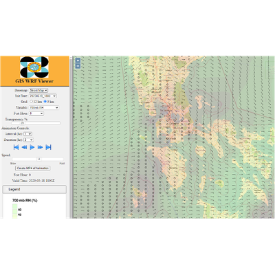
Radiometrics - Mesoscale Analysis and Prediction Support System (MAPSS)
The Mesoscale Analysis and Prediction Support System (MAPSS) is a complete operational mesoscale NWP system built upon the state-of-the-science Weather Research and Forecast (WRF) model. MAPSS includes a Graphical User Interface allowing users to set up WRF domains and monitor runs. WRF output can be provided to existing forecaster displays and a custom GIS web-based. WRF viewer can be provided. MAPSS can be installed on local hardware or run in the Amazon Web Services cloud.
Radiometrics - Launch Weather Decision Support System (LWDSS) Software
LWDSS is an atmospheric profiling instrumentation, integration, decision support, and visualization system that provides real-time continuous observations and nowcasting tools to support spaceports and ranges.
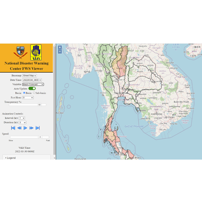
Radiometrics - Hydromet Decision Support System (HDSS)
HDSS provides professional tools and displays designed to aid users in real-time decision-making regarding weather monitoring, nowcasting, flash flooding, water resource management, heavy rain events, and landslides.