

- Home
- Companies
- Ramboll Shair
- Software
Ramboll Shair software
Shair Tech
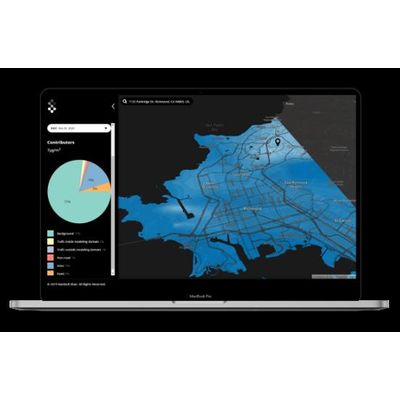
Shair Tech is the contextual layer to the Shair Map, to support decision-makers as they develop pollution strategies. By going into the map to answer why the air quality is what it is with features like historical data averaging, comparison mode, and source apportionment, decision-makers are able to see patterns and identify pollution-mitigation strategies with the greatest impact. Shair Tech gets communities on the path to doing something about the air by giving them data and a visual layer that enables identification of strategy.
Shair Map
Shair Map is the primary visual layer of the model. With 10-meter resolution, the community is able to see pollutant concentrations on a block-to-block basis – visualizing the air where they live, work, and learn. With real-time updates, historical and forecast data, community members can make better decisions all the time to protect their health, and advocate for change. This Map empowers communities to understand the environment around them.