

SarVision B.V.
3 software found
SarVision B.V. software
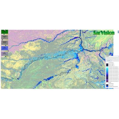
SarVision - Flood Monitoring Software
Semi-automated algorithms are used to create consistent time-series of flooding and water extent. With this system flood frequency and duration maps can be made based on a combination of Sentinel-1 and PALSAR-2 radar images. Note that flooding is also mapped under the tree canopy!
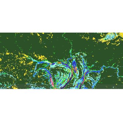
SarVision - Baseline Mapping Software
A solid Baseline is the best starting point for detecting changes.
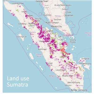
SarVision - Natural Capital Accounting Software
SarVision produces wall–to-wall maps of ecosystem capital and elaborate natural capital accounts. We develop for example state of the art biomass and land use maps.