
Sensors & Software - an SPX Corporation brand products
LMX
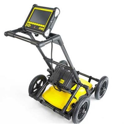
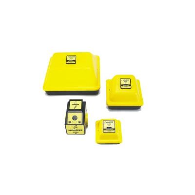
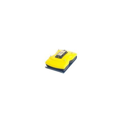
Sensors & Software - Model LMX100 - Non-Metallic GPR Utility Locator
As one of the most affordable GPR utility locating tools, LMX100™ completes the locator’s toolbox, offering a more complete picture of the underground infrastructure. Offers the perfect balance of depth penetration and high resolution for accurate locating. LMX Family is a non-destructive Ground Penetrating Radar (GPR), that can locate utilities that cannot be located using traditional methods (EG. PVC materials, or utilities that contain broken tracer wires.)
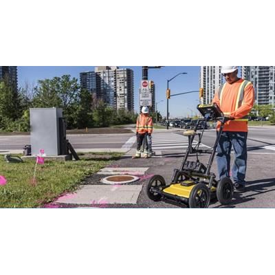
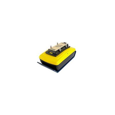
Sensors & Software - Model LMX200 - Ground Penetrating Radar (GPR) Locating Tool
GPR is widely used for Utility location and is used for identifying and marking utility mains that are underground. Typical underground utilities include lines for natural gas, cable television, fiber optics, telecommunication, electricity distribution, traffic lights, street lights, etc.
Other Products
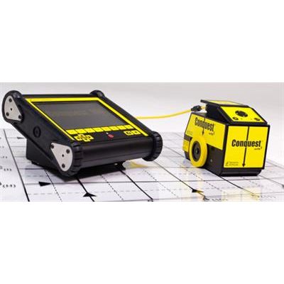
Sensors & Software - Model CONQUEST 100 - Ground Penetrating Radar System (GPR)
CONQUEST GPR: Get rapid, reliable results and reduce the need for destructive testing. CONQUEST® GPR is a light, portable device that provides a fast, non-invasive method to gain accurate insights of objects below the concrete surface, even on a curved surface or column. CONQUEST® GPR reduces risk by detecting rebar, post-tension cables, metallic and non-metallic conduits as well as current-carrying wires embedded in concrete. Once your concrete scan is complete, CONQUEST® GPR connects to your mobile device, allowing you to email information directly from the field. Back in the office view your data and make client-ready reports in minutes.
Sensors & Software - Model pulseEKKO - High Performance Geophysical Survey Systems
pulseEKKO® GPR systems provide unparalleled performance with a wide-range of frequencies for applications ranging from deep mineral exploration and glaciology to high-resolution geotechnical investigations and concrete imaging.
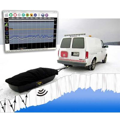
Sensors & Software - Model IceMap™ - Accurate, Real-Time Ice Thickness Measurements System
Safety is the primary concern when using these roads to haul goods, equipment and people. The conventional method is to core at intervals along the route and measure the ice thickness to estimate the load bearing capacity of the ice. However, ice conditions can change rapidly and coring at large distance intervals results in imprecise information.
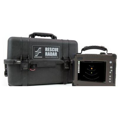
Sensors & Software - Ground Penetrating Rescue Radar (GPR)
Rescue Radar™ is designed for rapid deployment by Search & Rescue teams all around the world to quickly find survivors trapped beneath the surface. Determining the presence of life is of utmost importance following a disaster and Search & Rescue teams need to rapidly assess where to focus their resources in the initial hours following the catastrophe. By making use of our innovative data processing algorithms and ultra-wide band (UWB) antenna technology, Rescue Radar is able to detect movement and immobile victims below the surface.
Noggin Systems

Sensors & Software Noggin - Model 100 - Low Frequency, Deep Sounding GPR
The Noggin 100 provides low frequency, deep sounding GPR capability with a center frequency of 100 MHz. Designed for true portability, the Noggin 100 has detachable antennas that allow the system to be packed easily for shipping or transport, even by backpack! The Noggin 100 retains all the simplicity and integrated form factors that have made the other members of the Noggin family so popular.
Sensors & Software Noggin - Model Ultra 100 - Adaptable GPR System
The NOGGIN Ultra 100 has all the capability of the Noggin 100 described above with the addition of Ultra Receiver technology. This allows the system to stack the data traces up to 65,536 times to reduce the random radio frequency noise floor and increase the depth of penetration – all with little to no increase in data collection speed. To learn more about Ultra Receiver technology see Ultra Receiver.
Sensors & Software Noggin - Model 250 - Workhorse for Subsurface Mapping
The Noggin 250 is the workhorse for subsurface mapping. With a center frequency of 250 MHz this system provides the optimal balance between depth of penetration and resolution. This durable system is the most popular of the Noggin family.
Sensors & Software Noggin - Model 500 - Adaptable GPR System
The Noggin 500 is used for applications requiring high resolution with a medium level of exploration depth. It features a center frequency of 500 MHz.