

SubTerra Geoservices LLC services
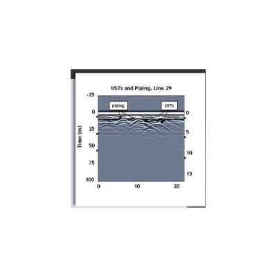
Ground Pentrating Radar (GPR)
GPR works by sending a pulse of energy down into the subsurface and recording the strength and time required for a reflected signal to return. Reflections are produced when the energy pulse enters into materials with differing electrical conduction properties. GPR is very effective for locating USTs, utilities, piping, burials, foundations and other subsurface objects to significant depths. GeoSeek utilitzes GPR-Slice software to create 3-D GPR maps to identify subsurface anomalies.

Electromagnetic (EM) Terrain Conductivity and Induction
EM conductivity and induction investigations are a rapid and cost effective way to map landfills, locate USTs and buried drums/waste, as well as map shallow groundwater contamination.GeoSeek uses the Geonics EM31DL Terrain Conductivity Meter to measure soil conductivity and the Geonics EM61-MKII system for precision metal detection.
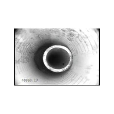
Borehole Video Logging
GeoSeek utilizes the GeoVision Jr. Heavy Duty down-hole video camera system to provide real-time visual investigations of boreholes and wells of all diameters to depths up to 1000 feet. Video is viewed live on site, recorded digitally, and can be burned to a DVD for delivery to the client. view and insptect water and monitoring wells, vertical and horizontal boreholes find and view fractures, voids, caves, water inflow, cross or inter-bed water flows,
sand, gravel, and grout inspect piping, mines, caves, bridges, dams and foundations find and identify obstructions or lost items.