

Trimble products

Trimble - Model VerticalPoint - RTK Systems
Whether you’re a grower or a contractor, Trimble VerticalPoint RTK grade control achieves maximum vertical accuracy for all leveling and land forming operations. VerticalPoint RTK increases productivity of leveling projects during continuous in-field operations.
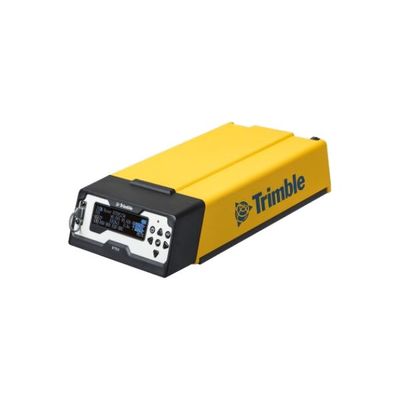
Trimble - Model R750 - Modular GNSS Receiver
The Trimble R750 GNSS receiver incorporates the latest industry-leading positioning technology from Trimble along with a full suite of modern communications capabilities, in a rugged, modular package that can be deployed anywhere. Convenient features, such as an integrated 4G LTE modem, four-line reversible front panel display, and USB-C PD charging, make the Trimble R750 a powerful tool for a variety of surveying applications.
3D Scanners
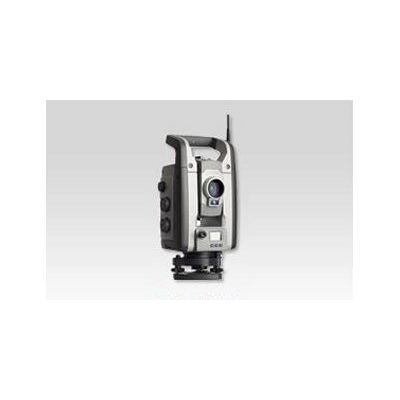
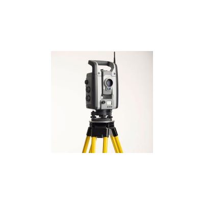
Trimble - Model VX Spatial Station - Spatial Station
Capture and combine scanning, imaging and surveying deliverables with the singular solution designed for surveyors. Integrating the technologies of advanced optical surveying, metric imaging and 3D scanning, the Trimble® VX™ Spatial Station is the only surveying instrument that does it all and does it with ease.
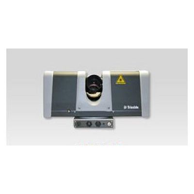
Trimble - Model FX Series - 3D Scanner
The Trimble FX Controller PC is an extended solution for operating the Trimble FX 3D laser scanner that improves mobility and productivity in the field. The FX Controller PC provides remote control of the Trimble FX scanner via a Wi-Fi connection from a laptop or touch screen device to simplify field operations. The system is delivered complete with pre-installed software, flexible power solutions and tripod mounting accessories to reduce setup time and increase efficiency.
Controllers
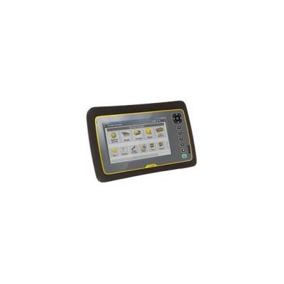
Trimble - Tablet Rugged PC
A Tablet Made for Surveying. Now there is no need to choose between the toughness and portability of a field controller and the operating power of a laptop—the Trimble Tablet Rugged PC is the one controller that does it all.
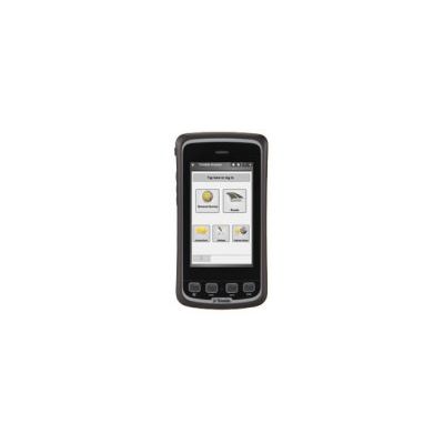
Trimble - Slate Controller
Powerful, connected, and compact, the Trimble® Slate Controller combines the convenience and ease-of-use of a smartphone with the durability for which Trimble is known. Its slim, ergonomic design is easy to grasp and its screen provides superior sunlight readability enabling all-day use by hard-working survey professionals
Natural Resources, Utilities and Government

Trimble - Model UX5 - High Precision Mapping and Surveying Solution
The Trimble UX5 HP is a professional aerial mapping system, designed to capture the highest image accuracy for survey applications. The features of the new UX5 High Precision include an integrated Trimble GNSS receiver, a powerful new camera, and a selection of camera lenses available for the ultimate in system flexibility.
3D Laser Scanning
Trimble - Model VX - Capture and Combine Scanning, Imaging and Surveying System
Capture and combine scanning, imaging and surveying deliverables with the singular solution designed for surveyors. Integrating the technologies of advanced optical surveying, metric imaging and 3D scanning, the Trimble® VX™ Spatial Station is the only surveying instrument that does it all and does it with ease. To improve the efficiency of capturing advanced Spatial Imaging deliverables, Trimble provides an integrated solution for bringing these technologies together within the traditional workflows surveyors already use. So you have the flexibility to perform feature-rich scans every day, without the complexity of setting up a separate scanning system or switching to specialized field software.