
- Home
- Companies
- Acteon Group Ltd.
- Products
- Seatronics - Model ULS 500 Pro - 2G ...
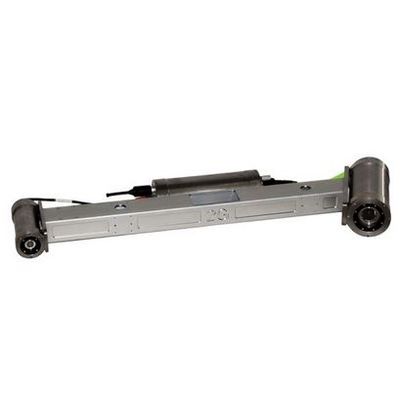
Seatronics - Model ULS 500 Pro -2G Robotics Underwater Laser Scanner
The ULS-500 Pro Underwater Laser Scanner is a mid-range measurement system that is ideal for capturing precision measurements in areas spanning 1.15m to 10m.
Spool Metrology
As part of a major North Sea installation contract, Subsea 7 selected 2G Robotics’ ULS-500 high precision underwater laser scanning system for a hybrid LBL/laser scanning solution to perform subsea spool metrology. The deployment was conducted in the North Sea at a depth of 90m. The customer’s objective was to design five spool pieces to connect a newly installed bundle towhead to five previously laid spool pieces.
Pieter Jansen, Survey and Subsea Data Manager, stated: “The end results were very impressive and the detail within the point cloud is fantastic. The operational time savings will be motivation to use this system again.”
AUV Pipeline Survey
2G Robotics recently delivered two deep-rated ULS-500 subsea laser systems to Oceaneering International, Inc.’s business unit, Oceaneering Survey Services (C&C Technologies) (“Oceaneering”), a leading provider of deepwater seafloor mapping services, subsea surveys and satellite positioning.
Including these two ULS-500 systems, Oceaneering now utilizes six of the ULS-500 systems with its Autonomous Underwater Vehicles (AUVs) as part of its advanced survey and inspection services for assessing pipeline and flowline integrity. Oceaneering has used the 2G Robotics ULS-500 system to accurately and efficiently inspect 2500 kilometers of pipeline and flowline.
2G Robotics’ underwater laser scanners can be deployed by ROV, AUV, or diver for stationary or dynamic scanning. The scanners generate submillimeter resolution 3D models of subsea assets and environments from which accurate measurements can be instantaneously and repeatably captured.
Operational Time Savings
- Real-time 3D model generation and verification of results
- No in-field calibrations required
Detailed Results
- Generates true-scale submillimetre resolution 3D models
- Collects high density point cloud data for identification of small features and defects
ULS-500 System Performance
- Performs long-range scans (1.15m to 10m range)
- 50° coverage and 360° degree rotation
- PPS time synchronization provides superior modeling accuracy compared to standard NTP approach
Deployment
- Configurable with AUVs and ROVs for dynamic scanning
- Deployable by ROVs and divers for stationary scanning
- Dedicated drivers in EIVA, QPS, and HYPACK software