

- Home
- Companies
- Avalon Sciences Ltd
- Products
- ALS Geochain - Model ASR-1 - Advanced ...
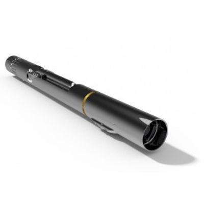
ALS Geochain - Model ASR-1 -Advanced Seismic Receiver
Geochain is established as the complete VSP digital seismic system, operating with up to 62 satellites for maximum logging and recording efficiency and is the result of over five years of research and development. The system is made up of individual satellites of our tried and tested ASR-1 borehole geophone, of which over 1000 are now in use worldwide. The Geochain system has been widely used by major players in the North Sea, North Africa, Gulf of Mexico, Canada and China with outstanding success.
- Ideal for VSP & Microseismic surveys
- Up to 62 satellites
- UPGRADED: Active Cooling System for continuous operation at 385°F/195°C
- 3” Outside Diameter Tool
- Standard 7 conductor wireline
- Real time data transmission
- Multiple 3 component sensor options
- 24-bit delta sigma convertors
- 25,000psi (1700 bar) pressure rating
- Up to 200m (>600’) between satellites
- Gapless recording for passive monitoring surveys
- Quick and easy conversion from Analogue to Digital operation
The GeochainTM VSP array has been designed for use in open and cased holes using standard 7 conductor wireline. The array is based on the field-proven ASR-1 downhole geophone and can be used in wells up to 25,000 psi (1,750 bar) and hole sizes from 3 1⁄2”-22” (89 to 559mm). The modular nature of the ASR-1 tool allows quick optimisation for various surveys ranging from high temperature deep well check shot to complex high sensitivity micro-seismic monitoring.
All the satellites’ locking arms open and close simultaneously and the entire string can lock into a 9 5⁄8” (244mm) well in only 30 seconds. All satellites have a failsafe arm mechanism for retrieval of the string in the event of power failure. All Inter-Tool Cables (ITC) use standard 7 conductor wireline. The cable heads have graduated weak links and composite pressure bulkhead connectors are used throughout. A rigid ITC (RITC) option is also available to preserve sensor orientation.
An optional TCU-2 tension head and motion detector provide real time surface read out to prevent tool hang up. A threshold alarm can be set to warn the wireline operator if tension or motion levels change. Full in-field processing is provided by our highly praised ACQ Software Suite featuring the latest VSProwess processing package.
Gamma Ray tool or CCL can be used for depth correlation and an auxiliary line is free for use with a downhole source or gyro tool. The system is tractor deployable for deviated wells.
When used in digital mode, the GeochainTM employs the TAS-2 telemetry adapter section and VRS-1 Voltage regulator section at the top and bottom of the tool string respectively. The ASR-1 HP downhole satellites are populated with the distributed electronic modules, which feature 24 bit Delta-Sigma converters for maximum dynamic range along with real time data transmission and display. Constant synchronisation of the string allows for very long record lengths.
Our latest unique active cooling system (ACS) allows continuous operation up to 385°F/195°C within a hermetically sealed environment, and the robust telemetry system will ensure operation in the harshest conditions.
Up to 62 satellites can be used in the array, with a maximum tool spacing of >600 feet (200m).
Analogue Mode
The modular construction of the standard (analogue) ASR-1 allows it to be easily converted to digital mode in just minutes. Replacement of the electronic module with a 200?C rated downhole amplifier (DHA) enables a single or dual level string to be deployed within very hot wells. The DHA and sensor pack can be upgraded to ASR-1 Extra High Temperature (EHT) to provide up to 225?C operational temperature.
Surface Control
This mode of GeochainTM operation is ideal for very hostile well deployment, such as deep check shot surveys. The requirement of only the ASR tool and no other telemetry/electronic devices (Gamma tools optional) allows the Geochain™ Analogue to be one of the most economic borehole seismic survey systems on the market.
Length: 35” (884mm)
Diameter: 3” (76mm)
Weight: 41lbs (19kg)
Max locking range: 12” (305mm) Standard or 22” (559mm) with an arm extender
Max locking force: 300 lbs (Standard Arm)
Temperature: 400oF (204oC) Analogue, 385oF (195oC) Digital (180oC for pre 2016 electronics modules AS270/271/273).
Pressure: 25,000psi (1750 bar)