Beijing Hydrosurvey Sci. & Tech. Co., Ltd.
- Home
- Companies
- Beijing Hydrosurvey Sci. & Tech. Co., ...
- Products
- Hydrosurvey - Model Bathyswath-2 - ...
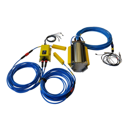
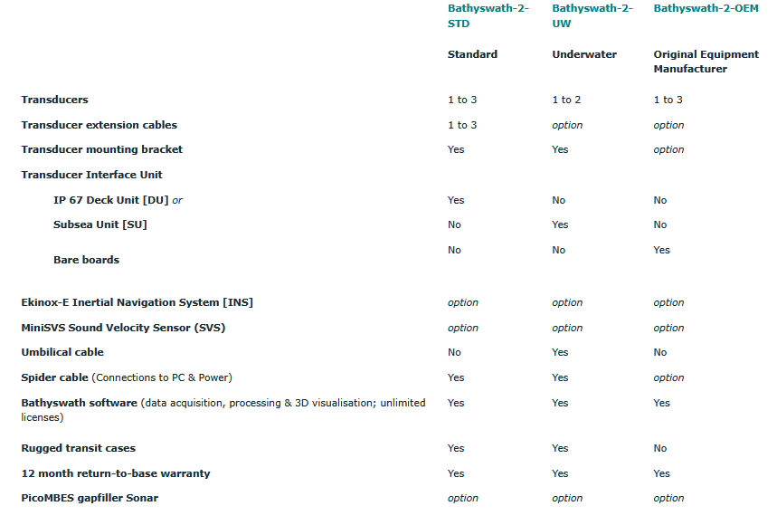
Hydrosurvey - Model Bathyswath-2 -Bathymetric and Seabed Mapping Survey System
Bathyswath is a comprehensive bathymetric & seabed mapping survey system, derived from the established & respected SWATHplus system, which became Bathyswath 1. Bathyswath 2 is the latest generation of our bathymetric systems.
Most popular related searches
- You will not find lower prices for a similar quality (IHO standards compliant, bathymetry and sidescan).
- Bathyswath uses wide swath widths, this increases survey speeds significantly, especially in shallow water.
- It has 3 frequencies: 117, 234 or 468 kHz to be used respectively up to 350, 200 & 80m of water depth.
- The US Geological Survey (USGS) said: `Operating swath of the bathymetric system ranged from 15 to 20 times water depth in in
- depths less than 15m"