

Beijing Hydrosurvey Sci. & Tech. Co., Ltd.
- Home
- Companies
- Beijing Hydrosurvey Sci. & Tech. Co., ...
- Products
- Bathyswath - Model 2 - Bathymetric & ...
Bathyswath - Model 2 -Bathymetric & Seabed Mapping Survey System
Bathyswath is a comprehensive bathymetric & seabed mapping survey system, derived from the established & respected SWATHplus system, which became Bathyswath 1. Bathyswath 2 is the latest generation of our bathymetric systems. You will not find lower prices for a similar quality (IHO standards compliant, bathymetry and sidescan).
Most popular related searches
seabed mapping
inertial navigation system
sound velocity sensor
bathymetry monitoring
bathymetry
mapping system
seabed survey
geological survey
sonar
process data acquisition
- Bathyswath uses wide swath widths, this increases survey speeds significantly, especially in shallow water.
- It has 3 frequencies: 1 1 7, 234 or 468 kHz to be used respectively up to 350, 200 & 80m of water depth.
- The US Geological Survey (USGS) said: “Operating swath of the bathymetric system ranged from 15 to 20 times water depth in in depths less than 15m”
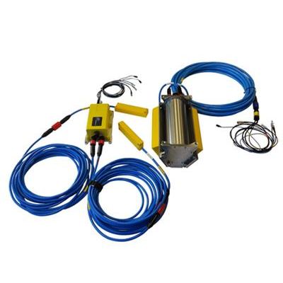
- Transducers 1 to 3 1 to 2 1 to 3
- Transducer extension cables 1 to 3 option option
- Transducer mounting bracket Yes Yes option
- Transducer Interface Unit
- IP 67 Deck Unit [DU] or Yes No No
- Subsea Unit [SU] No Yes No
- Bare boards No No Yes
- Ekinox-E Inertial Navigation System [INS] option option option
- MiniSVS Sound Velocity Sensor (SVS) option option option
- Umbilical cable No Yes No
- Spider cable (Connections to PC & Power) Yes Yes option
- Bathyswath software (data acquisition, processing & 3D visualisation; unlimited licenses) Yes Yes Yes
- Rugged transit cases Yes Yes No
- 12 month return-to-base warranty Yes Yes Yes
- PicoMBES gapfiller Sonar option option