

- Home
- Companies
- Durham Geo Slope Indicator (DGSI) - ...
- Products
- DGSI - Portable Measurement Systems
DGSI - Portable Measurement Systems
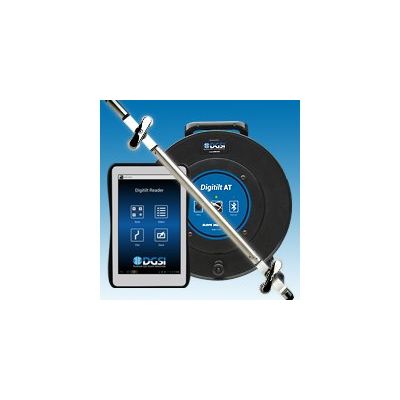
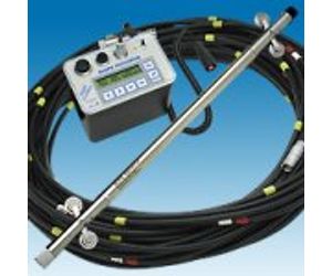
Portable measurement systems include a probe, cable, and readout. Portable systems are economical because they can be carried from site to site. They are accurate because the entire length of the casing is measured twice in each survey. The first survey establishes the initial profile of the casing. Subsequent surveys are compared to the initial. Changes in the profile indicate that movement has occurred.
Slope Indicator offers the Digitilt Classic System, which has been the world standard in precision and reliability for many years, and the Digitilt AT System, which takes advantage of newer technologies.
Inclinometers generate more data than most other types of sensors. For example, an ordinary survey may generate several hundred data points. Over time, tens of thousands of data points must be reduced, compared, plotted, and archived. Slope Indicator`s DigiPro2 Software is designed to speed these tasks.
Inclinometers are used to monitor subsurface movements and deformations. Typical applications include:
- Detecting zones of movement and establish whether movement is constant, accelerating, or responding to remedial measures.
- Checking that deformations are within design limits, that struts and anchors are performing as expected, and that adjacent buildings are not affected by ground movements.
- Verifying stability of dams, dam abutments, and upstream slopes during and after impoundment.
- Monitoring settlement profiles of embankments, foundations, and other structures (horizontal inclinometer).