

- Home
- Companies
- Inertial Labs, a VIAVI Solutions ...
- Products
- Inertial Labs - Model INS-D/DL-OEM - ...
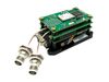
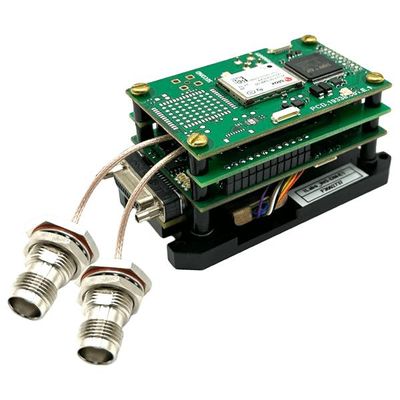
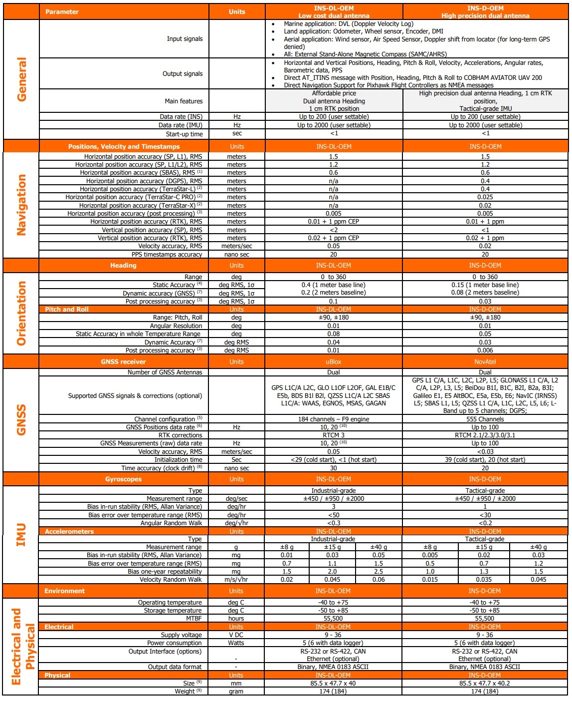
Inertial Labs - Model INS-D/DL-OEM -GPS-Aided Inertial Navigation System
The Inertial Labs GPS-Aided Inertial Navigation System (INS-D/DL-OEM) is OEM version of new generation, dual GNSS antenna, fully-integrated, combined GPS, GLONASS, GALILEO and BEIDOU GNSS and high-performance strapdown system, that determines position, velocity and absolute orientation (Heading, Pitch and Roll) for any device on which it is mounted. Horizontal and Vertical Position, Velocity, Dual Antenna Heading, Pitch & Roll are determined with high accuracy for both motionless and dynamic applications.
The Inertial Labs INS-D/DL-OEM utilizes advanced dual antenna GNSS receiver, 3-axes each of calibrated in full operational temperature range Advanced MEMS Accelerometers and new generation of tactical grade MEMS Gyroscopes to provide accurate Position, Velocity, Heading, Pitch and Roll of the device under measure.
INS-D/DL-OEM contains Inertial Labs new on-board sensors fusion filter, state of the art navigation and guidance algorithms and calibration software.
- Real time (RTK) & Post Processing (PPK)
- Position accuracy = 0.5 cm (PPK) / 1 cm (RTK)
- Heading accuracy = 0.03 deg (PPK) / 0.05 deg (RTK)
- Pitch & Roll accuracy = 0.006 deg (PPK) / 0.08 deg (RTK)
- High precision dual antenna GNSS receiver
- Ideal solution for accurate point clouds
- Small Size, light weight
- Affordable price
- Compatible with LIDAR, Optical camera
- Applications: flight control, remote sensing, photogrammetry
- Commercially exportable Dual Antenna GPS-Aided Inertial Navigation System
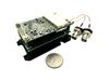
- 85.5 x 47.7 x 40 mm size and 174 (or 184) grams in mass. Full temperature calibration of all sensing elements
- Industrial & Tactical-grade IMU (1-3 deg/hr gyroscopes Bias in-run stability)
- GPS, GLONASS, BEIDOU, SBAS, DGPS, RTK supported signals
- Up to 0.05 deg Heading and 0.08 deg Pitch & Roll accuracy
- Compatibility with LiDARs and Optical Cameras for remote sensing applications
- Up to 200 Hz INS, up to 2000 Hz IMU, up to 100 Hz GNSS positions and GNSS measurements data rate
- Advanced, extendable, embedded Kalman Filter based sensor fusion algorithms
- State-of-the-art algorithms for different dynamic motions of Vessels, Ships, Helicopters, UAV, UUV, UGV, AGV, ROV, Gimbals and Land Vehicles
- Implemented ZUPT, GNSS tracking angle features
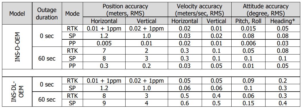
(1) GPS only
(2) Requires a subscription to a TerraStar data service
(3) RMS, incremental error growth from steady state accuracy. Post-processing results using third party software
(4) 2 meters base line between two GNSS antennas
(5) tracks up to 60 L1/L2 satellites
(6) 50 Hz while tracking up to 20 satellites. 20 Hz position update rate for Basic model of INS;
(7) dynamic accuracy may depend on type of motion
(8) time accuracy does not include biases due to RF or antenna delay
(9) Weight and size are PN dependent. Customers should obtain the most recent 2D/3D files before designing any interface hardware. In bracket shown weight for a device in standard configuration with internal datalogger
(10) if tracking GPS only