

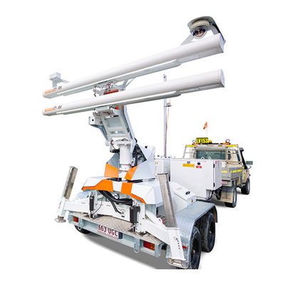
GroundProbe - Model SSR-OMNI -Rotational 2D Real Aperture Radar (RAR)
With a quick and all-encompassing scan, the SSR-Omni is designed to detect hotspots of movement across broad tailings dams. It is a rotational 2D Real Aperture Radar (RAR) capable of monitoring mine sites with 360° scan coverage as well as the highest precision and resolution. The SSR-Omni is a full-coverage, high-resolution monitoring solution that delivers beautiful data. Delivering unique real aperture measurements you can trust, the SSR-Omni is a high-confidence, real-time monitoring and alarming system.
HIGHEST RESOLUTION WITH THE SHARPEST DEFINITION
With its fine spatial footprint defined by its 2.74m aperture baseline, the SSR-Omni is the highest resolution rotational radar in the market.
It is also equipped with the sharpest of definition modes; selectable between 0.08, 0.24 and 0.33 degree pixels, each at 0.1 millimetre accuracy.
Its small pixel size allows its users to confidently locate and distinguish true areas of movement, with it the ability to see smaller movement earlier.
HIGH RESOLUTION WITHOUT THE EXCESSIVE DATA SIZE
Intelligent processing algorithms reduce the size of raw data by 96.5%, ensuring the smallest possible file size.
With only 9 megabytes of data per full-coverage 360° scan at 0.24 degree pixels, the data size reduction allows for critical monitoring even over a slow Wi-Fi link.
DATA DELIVERED FASTER
The SSR-Omni has an end-to-end scan time as fast as two minutes for a typical scan area.
It sweeps 360° in just 40 seconds to acquire its raw data and processing occurs at the radar in near real time.
MECHANICALLY ROBUST AND A HISTORY OF RELIABILITY
The SSR-Omni is built on GroundProbe’s latest SSR platform, backed by a long history of reliability, uptime and proven mechanical engineering.
On-board is the most reliable hybrid diesel generator system in the radar industry. It’s built tough, runs independent of weather and meets all current emission standards, globally.
SUPERIOR-RESOLUTION, PANORAMIC CAMERA
The SSR-Omni’s on-board imaging system is 40 megapixels in resolution, captures a full 180° panoramic view in one take and features multiple levels of zoom; able to capture the whole 360° scene fast.
High sensitivity lenses, together with true IR Cut night vision and innovative pixel binning, allow the camera to perform strongly in low-light scenes.
An IP66 rating together with internal heaters and blowers ensure condensation is managed and the system is protected from harsh mining environments.
REMOTE INSPECTION WITH DUAL-FEED, LIVE VIDEO STREAMING
Through its imaging system, users can conduct remote, real-time inspections, 180 degrees at a time.
Without leaving the office, users can zoom live in real-time or after an event.
ALL-ENCOMPASSING 360° SCANS
The system provides full-coverage, 360° monitoring.
Completing a 360° acquisition every 40 seconds, all new risks and deformation hotspots are detected quickly so that users can act on them fast.
LONG RANGE, EXTENSIVE COVERAGE
The SSR-Omni has a range of up to 5.6km with 11.2km coverage in-pit, easily meeting the needs of the world’s biggest mines.
Even at its longest range, the system maintains the highest resolution qualities with a sub-bench pixel size, ensuring precise, usable data.
ULTRA-PRECISE POSITIONING, IN-BUILT TILT SENSING AND AUTO-GEOREFERENCING
The SSR-Omni is equipped with an all-in-one GNSS, giving its users information about their radar’s location, alignment and tilt with great precision.
With geospatial positioning technology built-in, the radar’s location is also automatically geo-referenced in SSR-Viewer.
NEW INDUSTRY-DISRUPTING ATMOSPHERIC ALGORITHM
Three years in the making and a radical departure from current atmospheric correction methods, the new algorithm manages atmospherics better than ever before to deliver the cleanest data possible.
3D PIXEL SELECTION
Users have the ability to select individual or groups of pixels for analysis in our 3D visualisation, allowing for full analysis and charting capabilities on the one screen.
DATA AND IMAGE CO-REGISTRATION, MARKET-LEADING VISUALISATIONS
In SSR-Viewer, the data is visualised as a deformation heatmap and linked directly to the scene, providing spatially co-located information of every point.
SSR-Omni users can choose between two of our renowned data visualisation methods for analysis – 3D DTM View or Plan View.
Scan Area (Coverage):
Broad Area Mode: 360°AZ (adjustable) x 60°EL
High Definition Mode: 120°AZ x 60°EL
Communications:
Integrated wireless link or connect to mine network
End-to-End Scan Time*:
360° x 60° (2 minutes)* At maximum capacity, range, azimuth, and resolution the scan time may increase to about 3 minutes.
Power Options:
RAPS (Y), CPS, CPS Extreme, Battery Box with AC
Range:
5,600m
Deployment Option:
Fixed and Mobile
Pixel Size at 1000 Metres:
Broad Area Mode (0.24°): 4.2m x 0.68m
High Definition Mode (0.08°): 1.5m x 0.68m
Deformation Measurement Accuracy:
0.1 mm or submillimetre
Error Increase Over Range:
Nil
Survival Wind Speed:
160km/hr
Operational Wind Speed:
100km/hr
Altitude:
0 to 5,000m
Humidity:
5% to 99%
Rainfall:
0 to 100mm/hr
Temperature:
Standard kit: -25°C to +55°C