
- Home
- Companies
- L3 Harris Technologies, Inc.
- Products
- Harris Geiger-mode - LiDAR System
Harris Geiger-mode - LiDAR System
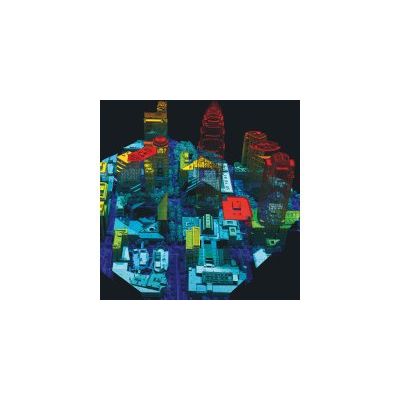
Harris` proprietary Geiger-mode LiDAR data collection delivers the most accurate high-resolution elevation data available from an aerial platform for land-use, urban, and emergency planning; civil engineering; transportation and utilities infrastructure management; and natural resource management.
One High-resolution LiDAR Collection Has Many Applications
Geiger-mode LiDAR technology allows us to collect elevation data points across large areas of land from high altitudes with high-resolution results and point densities up to 100 points per square meter (ppsm).
Areas exceeding 2,000 square miles can be captured in just one week’s time, allowing end users to obtain single-season data collection across wide areas. We offer custom-flight data collection of high-resolution LiDAR point cloud elevation data, off-the-shelf data sales for selected areas, and other custom value-added products and services for a variety of industries from our expanding library of calibrated point cloud data.
Harris uses an innovative approach that achieves higher-quality results and delivers fine feature detail from higher flight altitudes, for the highest efficiency possible. The system offers a unique design that collects data tied with a multi-angle illumination pattern to improve foliage penetration, remove shadows, and eliminate voids, yielding the most uniform, accurate, highest-resolution LiDAR data on the market today.