

- Home
- Companies
- Satellite Imaging Corporation
- Products
- Model Albedo - Satellite Constellation ...
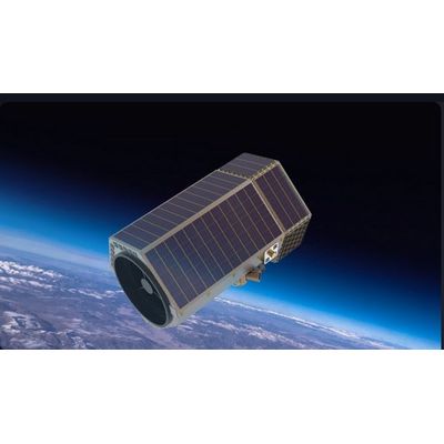
Model Albedo -Satellite Constellation (10cm)
Advanced and upcoming Albedo Space Corporation (Albedo) with office locations in Denver, Colorado and Austin, Texas, USA will offer 10-centimeter high-resolution electro-optical satellite imagery to customers within local governments, private industry, energy, insurance, agriculture, environmental, wildlife conservation, monitoring carbon and methane offset, and many other applications. In July 2020, Albedo was granted a license to collect 10-centimeter commercial panchromatic satellite imagery from NOAA and 40-cm 4-band (RGBN) multispectral imagery. The imagery will improve and aid government agencies and commercial companies in the applications of engineering, agriculture, forestry, urban planning, and many other AI and remote sensing applications.
Albedo will start launching the first satellite during 2024 and plans to complete the constellation of 24 satellites in 2027. The Albedo satellite constellation will aid in projects involving, forest fires, inspection of solar panel arrays, wild life detection and monitoring, carbon and methane mapping to address critical greenhouse gas emissions and climate change issues caused by excessive methane and CO2 emissions, by using the thermal bands with a spectral range from 7.5 µm to 13.5 µm (Microns). Albedo`s "Tier 3" licensing will bring new advances in the field of satellite remote sensing technology.
With new satellite constellations being launched, covering a spectral range of 0.4 µm to 13.5 µm, and the availability of Artificial Intelligence (AI), Machine Learning (ML), Computer Vision (CV) algorithms and management systems, industrial and natural emissions can be detected to monitor climate change to understand and observe the changes in our weather and environment.