

Model Nimbo -Earth Map and Time Machine
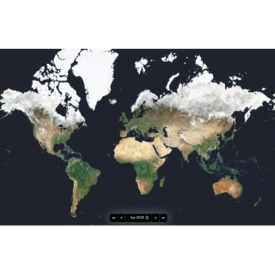
Nimbo Earth Online is a revolutionary platform that combines high-frequency satellite imagery updates, clarity, data diversity, and ease of use like no other. Offering cloud-free monthly updates with a resolution of 10 meters per pixel, Nimbo provides up-to-date views of Earth, unlike Google Earth which can have outdated images by several months or even years. This platform uses Sentinel 1 and 2 images from the EU’s Copernicus program, processed through Kermap's exclusive deep-learning techniques to clear clouds and harmonize colors. Nimbo allows users to explore detailed satellite images via a highly intuitive interface for free, making it ideal for students, researchers, journalists, environmental professionals, and geography enthusiasts. The platform features various data layers, 3D views, image comparison tools, and timelapse animations. Additionally, it offers high-quality basemaps compatible with GIS software, which can be accessed and utilized through an API token. By democratizing access to satellite data, Nimbo aims to support climate action and environmental monitoring, providing a valuable tool to measure, predict, and adapt to changes on our planet.
There are various satellite imagery sources out there. But none of them equals Nimbo when it comes to combining update frequency, clearness, data diversity and easiness of use.
Nimbo Earth Online is currently the only platform providing new satellite views of the world every month, without clouds. Resolution is at 10-m/px: true, this is far less precise from what is offered by Google Earth. However, Nimbo’s satellite views have the advantage to be up-to-date, whereas the tech giant’s may be several months, sometimes even several years old.
Nimbo Earth Online is the first platform letting everyone observe our planet’s latest transformations as they happen on the ground, in the most user-friendly fashion. All of this in free access, simply by signing up at the following address: maps.nimbo.earth.
Nimbo’s chronological views of the world are 100% developed in-house by Kermap and hosted in Europe. They rely on Sentinel 1 and 2 images supplied by the EU’s Copernicus programme, cloud-cleared and color-harmonized through exclusive deep-learning techniques for image processing (more on the topic)
A specialist in AI-driven geospatial analysis, Kermap thus reasserts its guiding ambition: making the most of innovative AI techniques and truly facilitate access to Earth observation.
Nimbo lets everyone explore the platform’s whole chronology of satellite images for free, and in the easiest way possible. So that more people, even not specialized in the field, can give a go at navigating geospatial imagery : students, researchers, journalists, environement or land management professionals, and of course all geography enthusiasts. All Nimbo visualizations are free to share and re-use for non-commercial purposes.
Any kind of user, even without geospatial knowledge, can explore land evolutions on Nimbo’s instantly browsable images, displayed in high resolution, thanks to super user-friendly features: