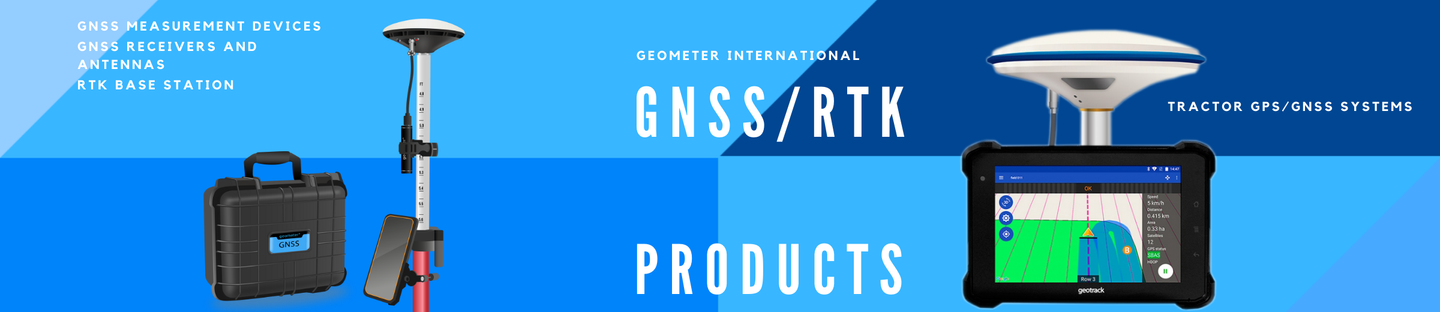

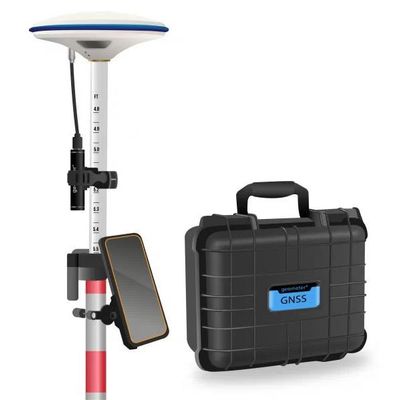
Geometer - Multi-frequency GNSS GM SMART M KIT
Multi-frequency GNSS GM SMART M KIT, L1, L2, L5, 965 channels, for performing of surveying works, such as: stakeout, determination of the exact boundaries of sites, land surveying, field area measurement, stake out points, stake out lines, GIS survey, stakeout roads, cross-section measurement, slope staking, power line survey, height control and other functions. Dedicated kit for centimeter-accurate positioning and high-precision positioning using Bluetooth wireless technology. The kit consists of a rugged smartphone, which is used as a controller with the SurvX mobile app installed and an external SMART M multi-frequency receiver. The kit comes in a sealed shockproof box.
Equipment:
- Rugged smartphone, RAM: 6 GB, internal memory: 128 GB
- SurvX mobile application
- Multi-frequency GNSS receiver GM SMART M
- Battery geometer Power Station 3400
- Storage and carrying box
- Pole mount for smartphone
- Power cable
- Mount for battery geometer Power Station 3400
Industries of use for the multi-frequency GNSS GM SMART M KIT:
- Surveying
- Cadastral work
- Construction support
- Machine control systems in construction
- Forestry
- Landscaping
- Utilities
- Precision farming
The main advantages of the multi-frequency GNSS GM SMART M KIT:
- Measurement accuracy 8 mm horizontal and 15 mm vertical;
- Fast initialization time due to the presence of triple frequencies L1, L2, L5 - that is, the time required for the receiver to obtain a solution in RTK mode;
- The receiver has 965 channels, receives a signal from satellite systems GPS, GLONASS, GALILEO, BEIDOU, QZSS, IRNSS;
- Flexible configuration of any CORS network that are provided in the World;
- Obtaining corrections 1024-1027 for local geodetic coordinates;
- Staking out using the GM SMART M is much easier than using a total station: the measurement can be done alone;
- GNSS receiver GM SMART M operates from 5V, which allows it to be powered from any external 5V battery or geometer Power Station;
- The perfect combination of reliability and value.
RTK METHOD
The essence of the GNSS RTK method is to receive a satellite signal simultaneously by a mobile rover at a point and by a base station at a known static point. The base captures the difference between the computed and actual data and sends the RTK correction to the rover. The GM SMART M KIT provides flexible adjustment of corrections from any available network broadcasting corrections via the RTCM protocol. Geometer company offers an effective solution - connecting GNSS RTK receivers to an RTK signal from a network of base stations. You can subscribe to RTK (receiving RTK corrections to the receiver) for a different period: a month, three months, half a year or a year. Multi-frequency GNSS receiver GM SMART M allows real-time geodetic measurements.
INCREASING PRODUCTIVITY
It is advisable to buy a multi-frequency GNSS RTK kit to significantly increase your productivity: with the help of satellite equipment you will be able to perform much more measurements alone than you would at the same time with a partner using optical equipment.
PROFESSIONAL ASSISTANT OF SURVEYOR
GeoMeter devices have very convenient and user-friendly software. Measured object files can be used in any application thanks to built-in file export capabilities. You can export data to the following formats: CSV, TXT, KML (for Google Earth). Also, using the Agroprofile website, you can display a field map on top of Google Maps maps in separate layers, get complete information about each field.
LARGE SCREEN FOR MAXIMUM CONVENIENCE
The rugged smartphone is equipped with a modern screen with IPS technology and a resolution of HD 720x1440 pixels. The increased screen brightness of 400 nits will allow you to work more comfortably even on a bright sunny day. It has scratch-resistant Gorilla Glass. Using it for geodetic work is easy, simple and convenient!
Dimensions (mm): 339 x 295 x 152 mm
Weight (kg): 3.3 kg
Manufacturer country: Ukraine
Accuracy: 1 cm
GNSS receiver type: GM Smart M
Brand: geometer
Number of channels: 965
Positioning horizontal accuracy: 0.008 m + 1 ppm
Positioning vertical accuracy: 0.015 m + 1 ppm
Sattelite systems: GPS: L1 C/A, L2C, L2P, L5; GLONASS: L1 C/A, L1P, L2 C/A, L2P; Galileo: E1, E5a, E5b, AltBOC; BeiDou: B1, B2, B3; BeiDou Global Signal: B1C, B2a; QZSS: L1C, L2, L5, L1C/A; IRNSS1; SBAS: WAAS, EGNOS, MSAS, GAGAN
Frequency: 1-20 Hz
Range of working temperatures: -40°C to + 85°C
Bluetooth: 4.2
Cold start: 40 sec
Warm start: 15 sec
Hot start: 1 sec
RAM: 6 Gb
Integrated memory: 128 Gb
Power supply : Battery
Communication standard support: 2G/3G/4G
Ingress Protection: IP67