

GEOTRAN
GEOTRAN - Network Survey Vehicle
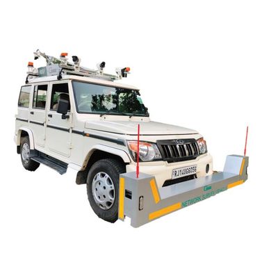
FromGEOTRAN
This system primarily consist of infrared laser height sensor`s, precision accelerometer`s, a distance measuring unit and PC to capture result. The complete system is state of art composed of hardware and software that Is mounted to a vehicle according to the customer`s data collection need. The profile can be configured with multiple height sensor, single and any sub system the client wishes. All data is collected in real time, displayed on flat panel for operator viewing, record on hard drive on future analysis and sent to printer for graphical report
Most popular related searches
road safety
road survey
road asset management
infrared sensor
accelerometer
inventory management
roadside monitor
roadside monitoring
accelerometer measurement
airport safety
- Pavement Rutting/Transverse Profile surveys,
- Longitude Profile & Roughness surveys,
- Network and project level road and asset collection surveys.
- Routine pavement monitoring surveys,
- Roadside inventory and asset management,
- Road geometry and mapping surveys,
- Contractor quality control,
- Road safety assessment,
- Airport runway maintenance.