

Novatest - Model GRT-XX -Multi-array GPR Ground Radio Imaging System
Antenna array with distributed receiving and transmitting high frequency (HF) antennas used to scan structure environment; this array helps sounding environment from different angles. For detection and localization of heterogeneities, we apply the method of mathematical focusing and technology of Synthetic Aperture Radar (SAR) where all the HF signals registered by the array are summed in phase for each specified focusing point with correction for the existing delay.
Thus, focusing is carried out by means of sequential summing of received signals with time delays equalization of the pulses scattered by the point with specified coordinates. Delays corresponding to the total time of the signal propagation from the transmitter to the object and back from the object to the receiver are introduced into the received signal. As next step amplitudes of the signals corresponding to calculated delays are summed up. The obtained result is a pixel/point of the radio-image with the appropriate coordinates. 3D image can be created by means of focusing for each point of the selected volume. Focusing is carried out in frequency domain with the use of the fast processing algorithms; thus, allowing real-time realization of 3D tomograms for the studied volume.
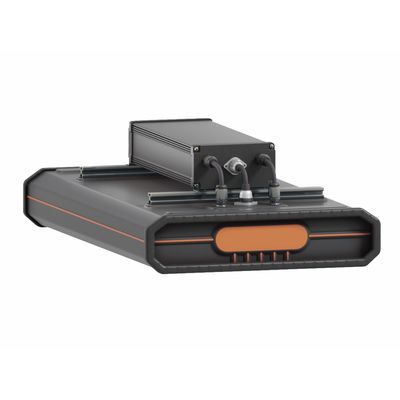
GRT-XX
- 0.2-3 GHz
- 43? channels
- 0.5-4.4 m scanning width
- minimum 7.5 cm channel spacing
The Scanner is a modular system consisting of the unit of HF pulses formation and receiving based on chirp generator and the antenna array unit. In addition to chirp HF pulses transmitter and the antenna modules, the Scanner also includes the navigator unit and the control computer.
Antenna array construction is module-based. Each module consists of four receiving and four transmitting antennas for 0.5 to 3 GHz band. The antenna modules can be cascaded together in a strip in order to expand the width of coverage or as a cross for two orthogonal polarizations sounding.
MAIN PURPOSES
Roads, railways, aerodromes
- Determination of the pavement thickness, railway embankment, runway elements, aerodrome steering tracks;
- Determination of the roof geometry of the natural base and ballast;
- Conformity control of the structure of pavement, railway embankment, runway design documentation strips;
- Identification of loose and flooded areas;
- Study of the features of reinforcing concrete slabs;
- Study of engineering and geological conditions of areas subject to –
deformation; - Study of the engineering and geological situation of the territories adjacent to airfields.
Utility detection
- Monitoring the status of underground utilities;
- Search and localization of sources of water leakage in underground pipelines;
- Determining the location of underground utilities, structures, etc;
- Mapping of underground utilities.
Civil engineering
- Determination of underground objects, cables, sewer and drain networks position;
- Search and localization of various defects in wooden, brick, reinforced concrete building structures;
- Clarification of engineering-geological and hydrogeological conditions of construction sites;
- Detection of fittings, hidden wiring, utilities;
- Search for hidden defects in the walls of engineering structures, mines, tunnels, in supports and ceilings.
Archaeology
- Localization and analysis of archaeological objects — burials, artefacts, household items;
- Mapping of ancient structures — identifying the location of the foundation and walls of destroyed buildings;
- Determination of the thickness of the cultural layer;
- Monitoring the status of architectural monuments hidden under the ground;
- A detailed study of archaeological sites.
Environmental supervision
- Localization of underground storages;
- Contouring the pollution zone, highlighting the flow of pollutants;
- Control of groundwater level dynamics.
Security
- Search for criminal burials, fire-arm caches, explosives, people caught in avalanche.
- Identification of unauthorised tie-ins into trunk pipelines.
Agronomy and soil science
- Localization of areas of high humidity;
- Drainage system mapping;
- Control and monitoring of the development of the root system of trees.
- High dynamic range antennas array
- Custom calibration procedure with hardware-dependent function
- Simplified functional of the control program – visualizations of maps, as well as profile curves
- Easy to use for controlling and data interpretation
- Open format for custom integration
- Cascade expansion for scanning width from 0.55m to 2.35m for GRT-3X and 1,1m to 4,4m for GRT-1X
- Full covering of scanning width with 7.5cm for GRT-3X and 15cm for GRT-1X resolution (no “dead zones” at all)
- Scanning on speed up to 160 km/h
- Fully compatible with software for packet post procession and interpretation – GeoReader (LLC «Technology Information Modeling»)