

Slantrange - Model 3PX -Multispectral Imaging System
Our 3PX multispectral imaging system brings all the sensing and analytics power of our 3P but with new levels of aircraft integration for improved reliability and efficiency, powered by DJI SKYPORT.
Integration is a Snap!
DJI’s M200 is a robust drone platform designed for heavy industrial and commercial use. That means sensor payloads often need to be reconfigured from mission to mission depending on data requirements.
3PX, with its new SKYPORT connector, allows for quick-and-easy installation on the DJI gimbal mount, providing the same seamless integration you get from DJI’s own cameras.
Once connected, the 3PX is automatically detected and configured through your flight control app.
Reliable New In-Flight Data
The 3PX SKYPORT integration also enables in-flight sensor data to be delivered direct to your flight controller. Currently compatible with DroneDeploy and Flight Plan for DJI, you can now configure your mission and sensor together and then monitor in-flight status, all from the same app.
Access to important in-flight data ensures that you’re getting the quality measurements you need to get, including 3PX sensor state, real-time sunlight measurements, image counter, and memory card status, with more to come soon!
DJI M200 Series Drone Platform with SLANTRANGE 3PX
Data That Matters
As with all SLANTRANGE sensors, the 3PX delivers ultra-high resolution multispectral imagery designed specifically for agricultural applications. Whether you’re using our SlantView analytics package, DroneDeploy, Pix4D, or your own analytical tools, 3PX image quality and accuracy forms the starting point for valuable new data analytics in agriculture. Some unique use cases include:
- Counting and sizing individual plants for improved yield forecasting
- Detecting weed growth for more precise herbicide applications
- Measuring plant health conditions for more efficient nutrient use
- Enabling users to train 3PX to find features and signatures of interest to their own operations with our proprietary SmartDetection algorithms
Data You Can Trust
3PX builds on SLANTRANGE’s reputation for data accuracy and trust. Changing sunlight conditions, variable soil types, and canopy density are all well-known error sources for other aerial measurement systems, from satellites to manned aircraft to low altitude drones. Only the SLANTRANGE sensor family includes the patented and essential technology to eliminate these error sources before they enter your data set – so you can trust your results for important decisions.
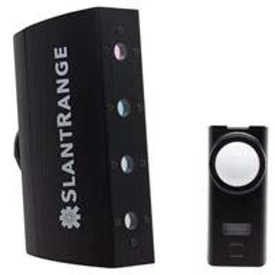
- Spectral Channels (Vegetation Sensor): 4
- Spectral Channels (Ambient Illumination Sensor): 4
- Processor Type: Qualcomm Snapdragon 801
- Processor Speed: Quad-Core 2.26GHz
- On-Board RAM: 2 GB
- Detector Type: Si CMOS
- Available Spectral Range: 410 - 950 nm
- Band Positions: Selectable
- Shutter Type: Global
- Positioning & Pointing: Integrated GPS/IMU with Extended Kalman Filter
- GSD @ 120 m AGL: 4.8 cm
- Recommended Image Overlap: 20% (SlantView Analytics only)
- Linear Coverage Rate @ 120 m AGL, 20 m/s: 1,000 Acres/Hour
- 160 Acre Survey @ 120 m AGL, 20 m/s (fixed wing): 17 Minutes
- 160 Acre Survey @ 120 m AGL, 12 m/s (multi-rotor): 25 Minutes
- Available Information Layers: Population Density, Population Size Distributions, Emergence Fraction, Weed Coverage, Stress, Vegetation Fraction, Chlorophyll Index, Yield Potential, GNDVI, RNDVI, Red Edge NDVI, Color, User-Defined Smart Detection
- On Board Data Storage (Removable): 64 GB (4 hours)
- Output Formats: KML, SHP, GeoTIFF
- Size (Vegetation Sensor): 14.6 x 6.9 x 5.7 cm
- Size (Ambient Illumination Sensor): 8.1 x 3.5 x 1.7 cm
- Weight: 425 g
- Power: 11 W via DJI SKYPORT
- Patents: 9,470,579 9,791,316