

Weatherford
- Home
- Companies
- Weatherford
- Products
- SpectralWave - Spectral-azimuthal Gamma ...
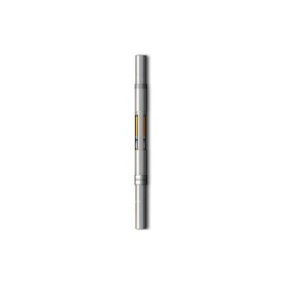
SpectralWave - Spectral-azimuthal Gamma Ray Sensor
FromWeatherford
The SpectralWave® spectral-azimuthal gamma ray sensor provides azimuthal gamma ray borehole images, precise total gamma ray, and real-time potassium, uranium, and thorium (K, U, Th) data.
Most popular related searches
gamma ray
logging while drilling
while drilling
gamma sensor
horizontal well
spectral sensor
drilling equipment
drilling service
sensor data
borehole
Objectives
- Geosteer and drill the first lateral in the operator’s horizontal shale gas well.
- Maximize reservoir exposure by landing at the base of the pay zone and drilling across it for 3,545 ft (1,080 m) while accurately placing the well in the stratigraphic sequence.
Our Approach
- Weatherford deployed logging-while-drilling (LWD) systems—including the SpectralWave spectral azimuthal gamma ray sensor and the multifrequency resistivity (MFR™) sensor—and the hostile-environmentlogging (HEL™) measurement-while-drilling (MWD) system to provide realtime geosteering support for the entire lateral section.
- The SpectralWave sensor obtained data that resulted in a high-resolution gamma ray image. The Weatherford team used the image to ascertain structural dip information, to determine whether they were drilling with or against the rock strata, and to evaluate the organic richness and clay content of the reservoir while drilling.
- The team effectively geosteered the 8 1/2-in. lateral section for 3,545 ft (1,080 m) into the target zone
Value to Client
- Weatherford logging and geosteering services helped to drill the first lateral in the operator’s horizontal well in one run and to stay in the zone of interest.
- Using data from the SpectralWave sensor enabled geosteering and positioning the wellbore in the upper zone with the optimal petrophysical properties for increased production and profitability.