Digital Forest Information Planning and Consulting
- Home
- Companies
- Digital Forest Information Planning and ...
- Products
- 3D Maps - Surface models, anaglyph ...
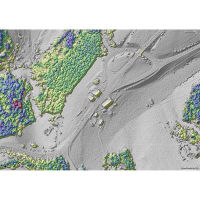
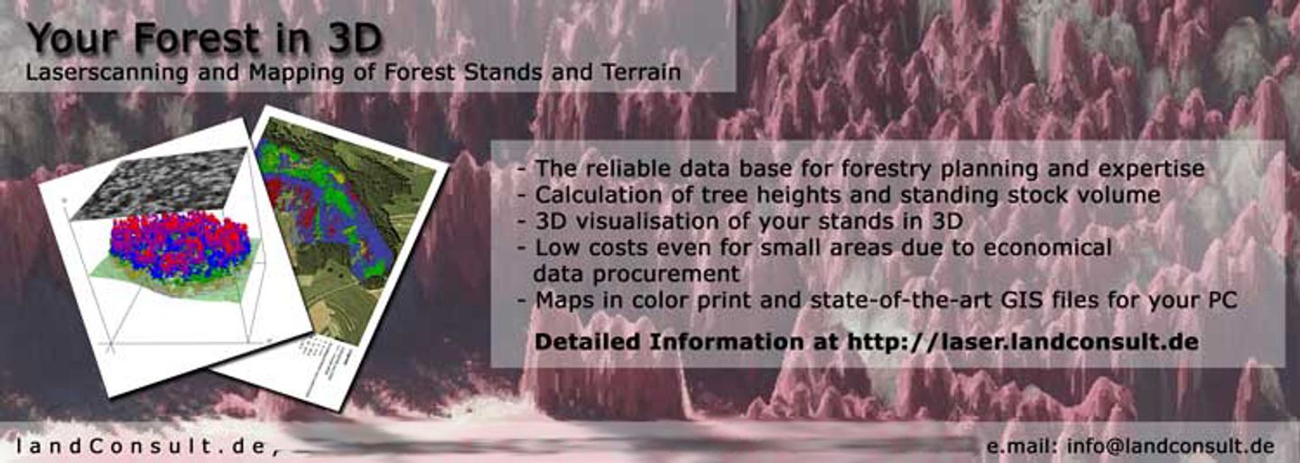
3D Maps - Surface models, anaglyph images, web maps and more ...
3D mapping of natural and urban landscapes. Maps are generated from stereo pairs of aerial or satellite photographs, or from LiDAR data. All in GIS compatible formats. Mapping services can include: - Landscape features with height information - Object classification - Visibility analysis - Height and volume calculation of objects - 3D change detection using images from different years - Data aquisition (organising LiDAR and imagery flight campaigns)Most popular related searches
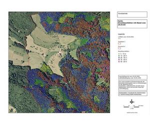
3D Mapping of your Area of Interest. Based on aerial, laser or satellite data.