Kontur Ground - Ultimate Tool
GROUND is the ultimate tool for the mapping and detection of both shallow and deep subsurface objects and structures. This versatile all-rounder can be applied in a variety of projects and will always produce 3-dimensional, high-accuracy and high-resolution subsurface imaging.
The GROUND sensor array is in contact with the surface which enables higher resolution and deeper subsurface imaging. Featuring customizable survey settings to adapt to the application. Used worldwide for utility mapping, bridge deck assessment, road, rail, archaeology, and aviation projects.
GROUND is a multi-application sensor.
7.5 cm channel spacing in the antenna array combined with a 30 MHz to 4,500 MHz bandwidth ensures high-density sampling to enable detailed visualization of the subsurface. The data is presented in three dimensions, geospatially referenced and intuitively handled in our software to make evaluation as natural as possible.
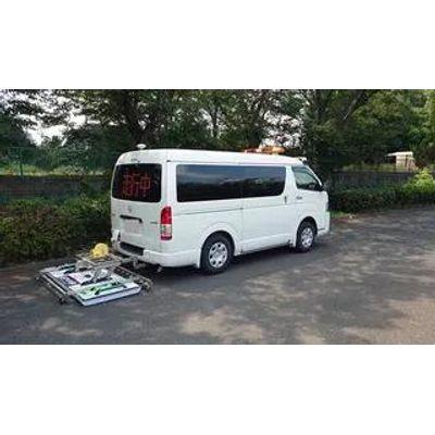
The GROUND sensor is equipped with integrated RTK GPS & IMU for easier deployment and accurate positioning. Compatible with mobile mapping solutions and external positioning systems. This flexible sensor can be used alone or integrated into a survey vehicle.