

Electromagnetic Methods
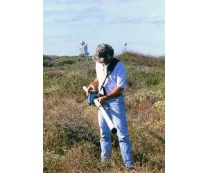
Electromagnetics uses inductive techniques to measure conductivity of the subsurface without the need of electrodes or ground contact. The methods include frequency domain electromagnetics (Geonics EM-31, EM-34, EM-38 and GSSI Profiler), time domain electromagnetics (Geonics EM-61, Geonics PROTEM systems and White handheld systems), and VLF systems. Depending on the target, the depth of investigation can range from a few meters to several hundred meters.
Frequency Domain systems measure the magnitude and phase of an induced current. The readings can be integrated with a sub-meter GPS system to facilitate quick and accurate data collection. GeoView uses frequency domain electromagnetics to map:
-
Metallic buried debris
-
Conductive (ionic) ground water contamination
-
Archaeological artifacts
-
Mine spoils
-
Variable geological conditions
Time domain systems generate a pulsed current into the ground and measure the decay rate of a secondary magnetic field to determine the bulk conductivity of the subsurface. GeoView uses time domain systems to:
- Locate unexploded ordinance
-
Locate buried ferrous and non-ferrous metal for environmental and archaeological studies
-
Map saltwater plumes
-
Determine thickness of contaminate plumes
-
Map thickness of geologic strata
- Locate underground storage tanks
VLF systems measure the local tilt and ellipticity of very low frequency broadcasts. VLF data is used to:
-
Map water bearing fractures
-
Locate ore bodies
-
Locate faults
